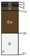
Taconic (50%)
Shallow Till
Lithic Dystrudepts
Somewhat excessively drained
Hydric: No
PAWS: 7 cm |
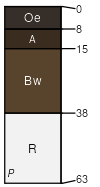
hills / Summit hills / Shoulder hills / Backslope
|
|
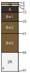
Hubbardton (20%)
Shallow Till
Lithic Udorthents
Excessively drained
Hydric: No
PAWS: 5 cm |
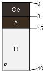
hills / Summit hills / Shoulder hills / Backslope
|
|
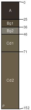
Rock outcrop (15%)
Rockland (reserved)
Hydric: Unranked
PAWS: 0 cm |

hills / Summit hills / Shoulder hills / Backslope
|
|
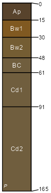
Macomber (5%)
Typic Dystrudepts
Well drained
Hydric: No
PAWS: 10 cm |
|
|
Dummerston (2%)
Typic Dystrudepts
Well drained
Hydric: No
PAWS: 26 cm |
|
|
Glover (2%)
Humic Lithic Dystrudepts
Somewhat excessively drained
Hydric: No
PAWS: 7 cm |
|
|
Vershire (2%)
Humic Dystrudepts
Well drained
Hydric: No
PAWS: 12 cm |
|
|
Cabot (2%)
Typic Humaquepts
Poorly drained
Hydric: Yes
PAWS: 9 cm |
depressions drainageways hills
|
|
Fullam (2%)
Aquic Dystrudepts
Moderately well drained
Hydric: No
PAWS: 10 cm |
depressions drainageways hills
|
|