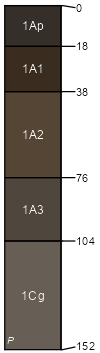
Lanton-Verdigris complex, 1 to 3 percent slopes, occasionally flooded
Lanton
(60%)
Wet Upland Drainageway
Cumulic Epiaquolls
Poorly drained
Hydric: Yes
PAWS: 37 cm
drainageways
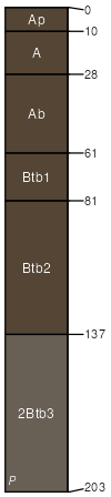
Verdigris
(30%)
Loamy Upland Drainageway
Cumulic Hapludolls
Moderately well drained
Hydric: No
PAWS: 42 cm
drainageways
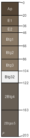
Hepler
(5%)
Wet Upland Drainageway
Mollic Endoaqualfs
Somewhat poorly drained
Hydric: No
PAWS: 41 cm
drainageways
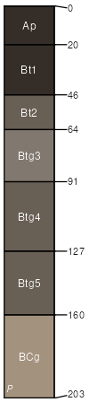
Summit
(5%)
Loamy Upland
Oxyaquic Vertic Argiudolls
Somewhat poorly drained
Hydric: No
PAWS: 24 cm
divides / Summit
SSA
Scale
Published
Export
mo011
1:24,000
1969
2025-09-02