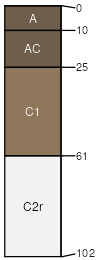
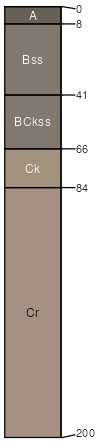
Keota (40%)
Loamy 17-20 PZ
Aridic Haplustolls
Well drained
Hydric: No
PAWS: 22 cm |
|
|
Epping (20%)
Shallow
Aridic Ustorthents
Somewhat excessively drained
Hydric: No
PAWS: 12 cm |
escarpments / Shoulder escarpments / Backslope
|
|
Badland (15%)
Non-site
Excessively drained
Hydric: No
PAWS: 15 cm |

ridges / Shoulder ridges / Backslope
|
|
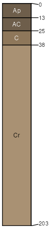
Orella (7%)
Shallow Clay
Aridic Ustorthents
Somewhat excessively drained
Hydric: No
PAWS: 7 cm |
hillslopes / Shoulder hillslopes / Backslope
|
|
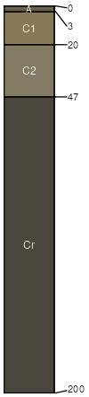
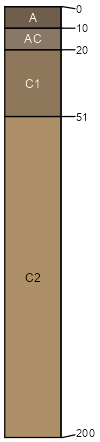
Cedarpass (6%)
Loamy 17-20 PZ
Torrifluventic Haplustepts
Well drained
Hydric: No
PAWS: 24 cm |
|
|
Whitewater (5%)
Dense Clay
Sodic Haplusterts
Well drained
Hydric: No
PAWS: 10 cm |
pediments / Backslope pediments / Footslope
|
|
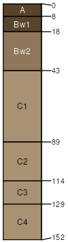
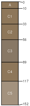
Colby (4%)
Thin Upland
Aridic Ustorthents
Well drained
Hydric: No
PAWS: 27 cm |
hills / Summit hills / Shoulder
|
|
Interior (3%)
Badlands Overflow
Aridic Ustifluvents
Well drained
Hydric: No
PAWS: 18 cm |
flood plains / Footslope flood plains / Toeslope
|
|