Libeg-Bearmouth-Mooseflat complex, 0 to 4 percent slopes
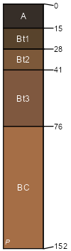
Libeg
(40%)
Upland Sagebrush Shrubland Group
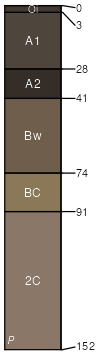
Ustic Argicryolls
Well drained
Hydric: No
PAWS: 8 cm
stream terraces
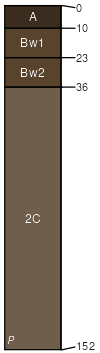
Bearmouth
(20%)
Upland Grassland Group
Ustic Haplocryolls
Excessively drained
Hydric: No
PAWS: 4 cm
stream terraces
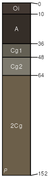
Mooseflat
(15%)
Bottomland Group
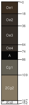
Typic Cryaquolls
Very poorly drained
Hydric: Yes
PAWS: 13 cm
stream terraces
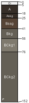
Narrows
(10%)
Subirrigated Grassland Group
Vertic Cryaquolls
Very poorly drained
Hydric: Yes
PAWS: 18 cm
drainageways
Foxgulch
(10%)
Bottomland Group
Fluvaquentic Haplocryolls
Somewhat poorly drained
Hydric: No
PAWS: 18 cm
flood plains
Tepete
(4%)
Subirrigated Grassland Group
Terric Cryohemists
Very poorly drained
Hydric: Yes
PAWS: 51 cm
marshes
Water
(1%)
Hydric: Unranked
PAWS: NA
SSA
Scale
Published
Export
id758
1:24,000
1998
2025-08-27