Cathro (42%)
Mucky Swamps
Terric Haplosaprists
Very poorly drained
Hydric: Yes
PAWS: 53 cm |
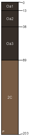
swamps / Toeslope depressions drainageways
|
|
Lupton (31%)
Mucky Swamps
Typic Haplosaprists
Very poorly drained
Hydric: Yes
PAWS: 81 cm |
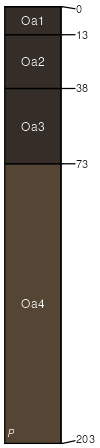
swamps depressions drainageways / Toeslope
|
|
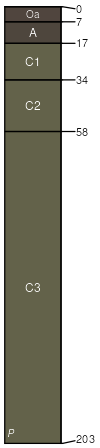
Arnheim (25%)
Floodplains
Typic Fluvaquents
Poorly drained
Hydric: Yes
PAWS: 39 cm |
|
|
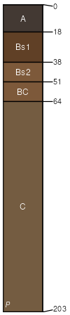
Annalake (1%)
Alfic Loamy Uplands
Oxyaquic Haplorthods
Moderately well drained
Hydric: No
PAWS: 34 cm |
|
|
Peshekee (1%)
Loamy Uplands
Lithic Haplorthods
Well drained
Hydric: No
PAWS: 6 cm |

ridges / Summit ridges / Shoulder ridges / Backslope ridges / Footslope moraines
|
|