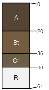
Connieo, bouldery-Ashbray, very bouldery-Rock outcrop complex, 2 to 15 percent slopes

Connieo (50%)
Shallow Sagebrush Shrubland Group
Lithic Argiustolls
Well drained
Hydric: No
PAWS: 5 cm
escarpments
hillsides
ridges
Ashbray (20%)
Shallow Cool Woodland Group
Lithic Ustorthents
Somewhat excessively drained
Hydric: No
PAWS: 3 cm
ridges
escarpments
hillsides
Rock outcrop (10%)


Hydric:
PAWS: NA
Rubble land (10%)


Hydric:
PAWS: NA
Catgulch (4%)
Shallow Shrubland Group
Lithic Haplustolls
Well drained
Hydric: No
PAWS: 3 cm
escarpments
hillsides
ridges
Jeffcity (3%)
Upland Sagebrush Shrubland Group
Typic Argiustolls
Well drained
Hydric: No
PAWS: 9 cm
escarpments
hillsides
ridges
Breeton (3%)
Upland Shrubland Group
Pachic Haplustolls
Well drained
Hydric: No
PAWS: 17 cm
terraces
alluvial fans
hillsides
SSAScalePublishedExport
mt6351:24,00020062023-08-30