Benfield-Kipson silty clay loams, 6 to 11 percent slopes, eroded
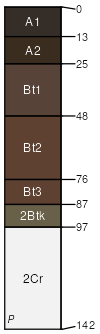
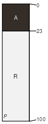
Benfield
(60%)
Clayey Upland
Udertic Argiustolls
Well drained
Hydric: No
PAWS: 14 cm
hillslopes / Backslope
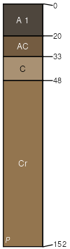
Kipson
(35%)
Shallow Limy
Udorthentic Haplustolls
Somewhat excessively drained
Hydric: No
PAWS: 6 cm
hillslopes / Backslope
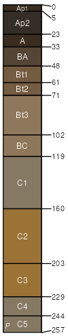
Sharpsburg
(2%)
Loamy Upland
Typic Argiudolls
Moderately well drained
Hydric: No
PAWS: 36 cm
hillslopes / Backslope
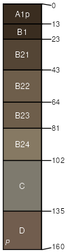
Wymore
(2%)
Clayey Upland
Aquertic Argiudolls
Moderately well drained
Hydric: No
PAWS: 36 cm
hillslopes / Summit
Sogn
(1%)
Shallow Limy
Lithic Haplustolls
Somewhat excessively drained
Hydric: No
PAWS: 4 cm
hillslopes / Shoulder
SSA
Scale
Published
Export
ne127
1:20,000
1983
2025-09-08