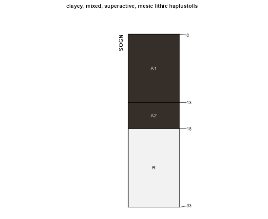
| Sogn rocky silt loam (moko) | So | 1544 | 566623 | m0m5 | ar143 | 1966 | 1:20000 |
Sogn soils, 25 to 40 percent slopes | 412G | 109 | 402181 | fhhl | ia001 | 1976 | 1:15840 |
Sogn-Gosport-Clanton complex, 9 to 18 percent slopes, moderately eroded | 413D2 | 1160 | 402683 | fj0s | ia007 | 1970 | 1:15840 |
Sogn loam, 5 to 14 percent slopes | 412D | 609 | 404421 | fktv | ia045 | 1978 | 1:15840 |
Sogn loam, 2 to 9 percent slopes | 412C | 1607 | 405425 | flw7 | ia061 | 1983 | 1:15840 |
Sogn loam, 5 to 14 percent slopes | 412D | 2171 | 406952 | fngh | ia089 | 1969 | 1:15840 |
Sogn loam, 14 to 40 percent slopes | 412F | 1400 | 406953 | fngj | ia089 | 1969 | 1:15840 |
Sogn loam, 2 to 5 percent slopes | 412B | 319 | 406951 | fngg | ia089 | 1969 | 1:15840 |
Ringo-Sogn complex, 5 to 15 percent slopes | 8877 | 2 | 1427134 | 2wwds | ks001 | 1975 | 1:24000 |
Sogn-Vinland complex, 3 to 25 percent slopes | 4752 | 12 | 1480270 | 2wvzj | ks005 | 1998 | 1:24000 |
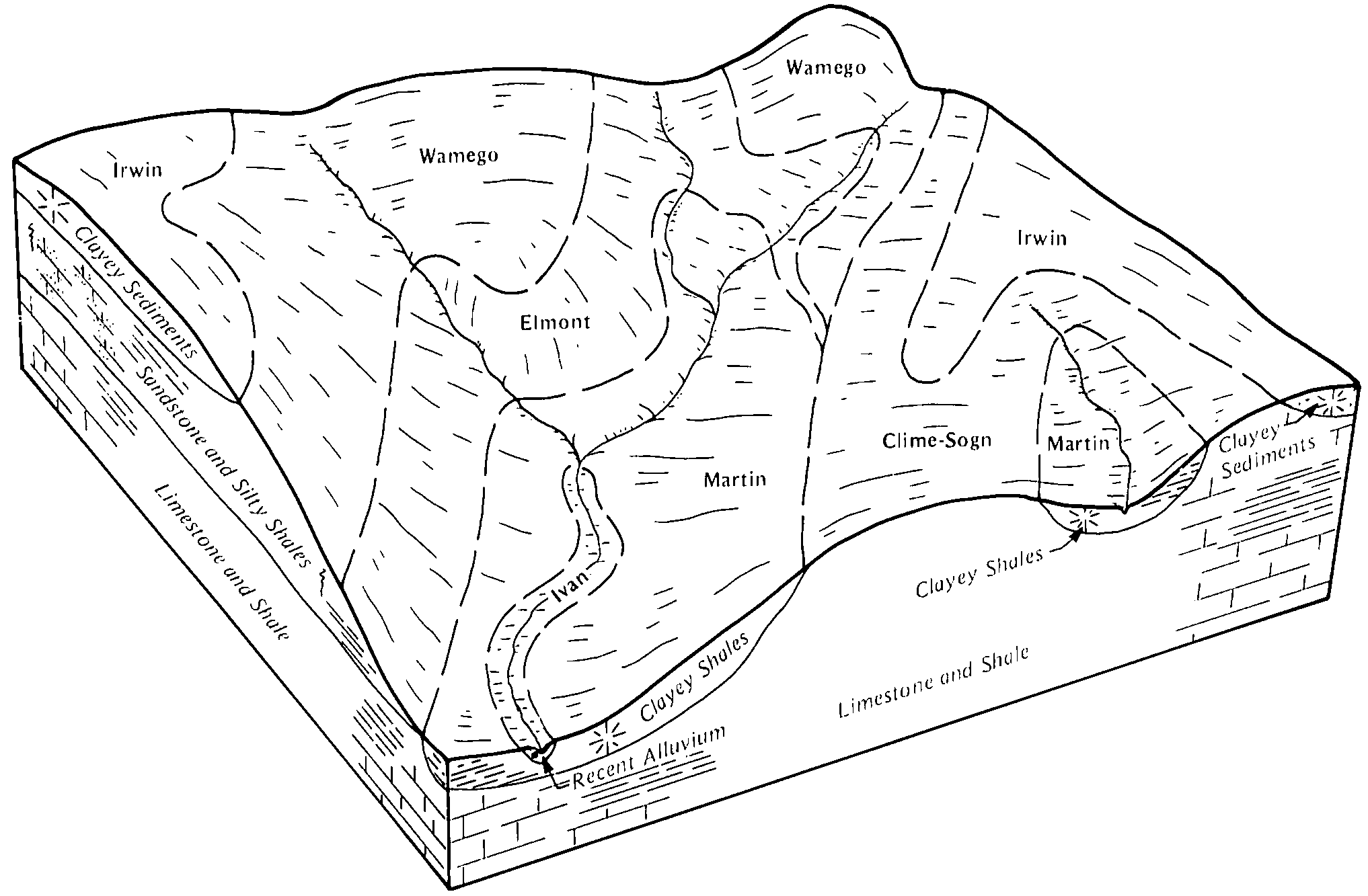
Kipson-Sogn complex, 5 to 30 percent slopes | 4725 | 3313 | 1152154 | 2ww04 | ks013 | 1994 | 1:24000 |
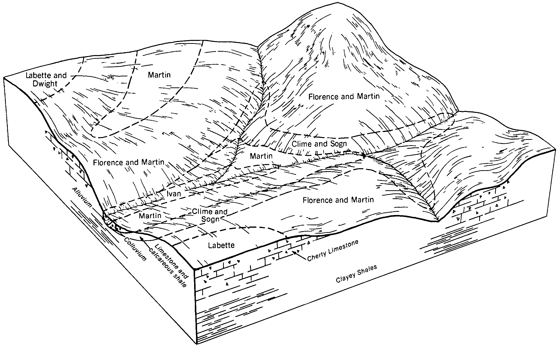
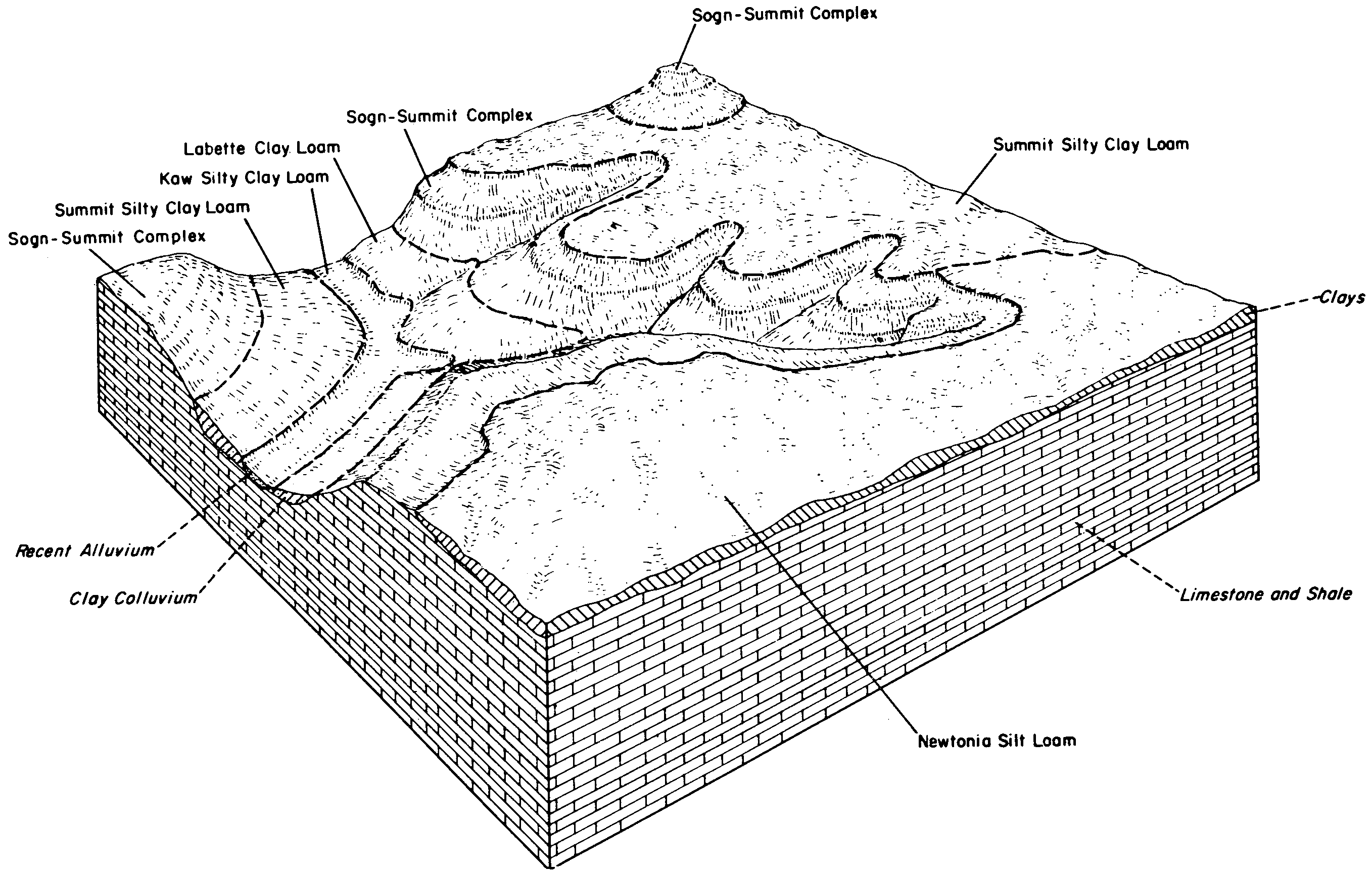
Labette-Sogn silty clay loam, 0 to 8 percent slopes | 4746 | 49178 | 2733309 | 1igwr | ks015 | 1970 | 1:24000 |
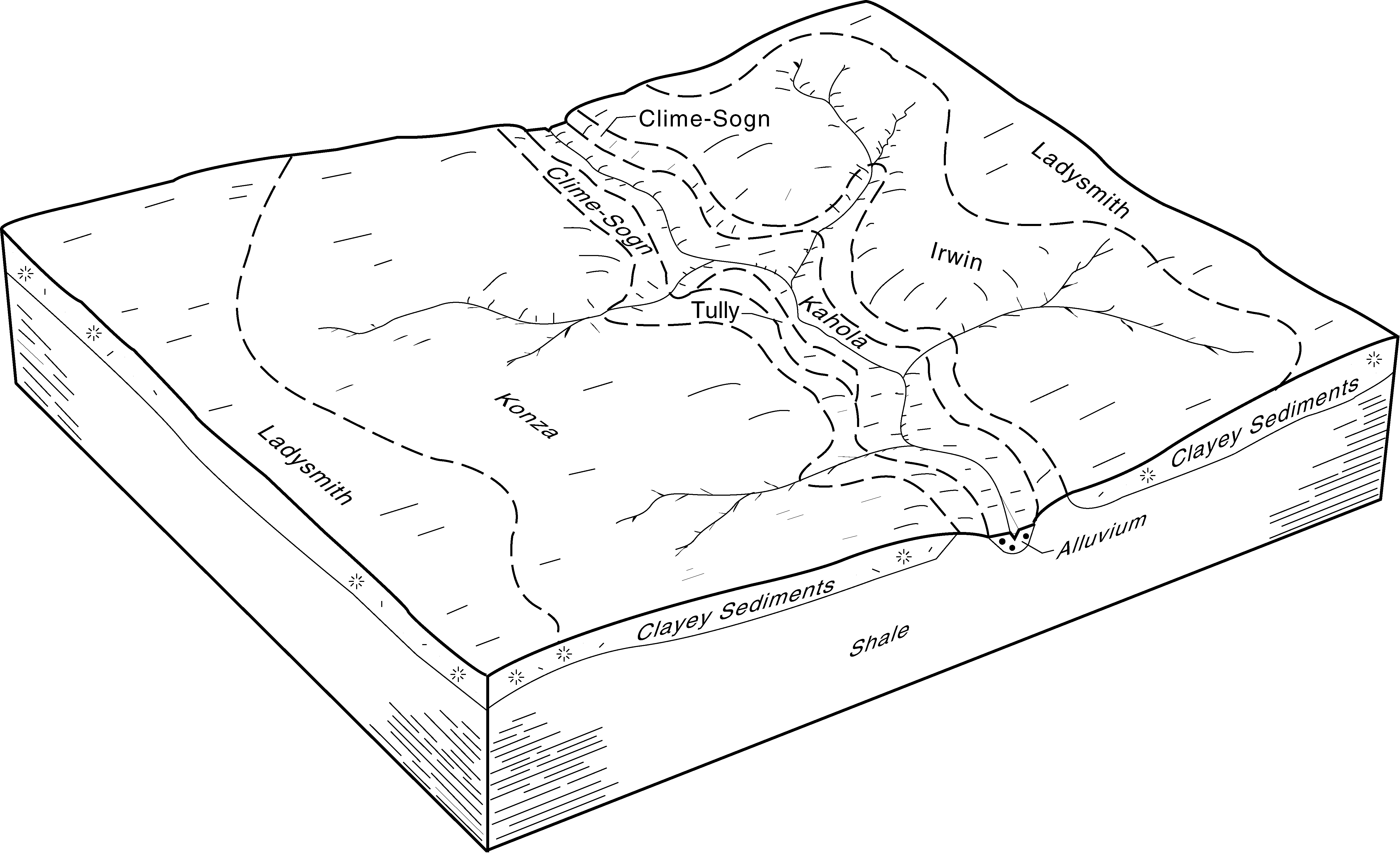
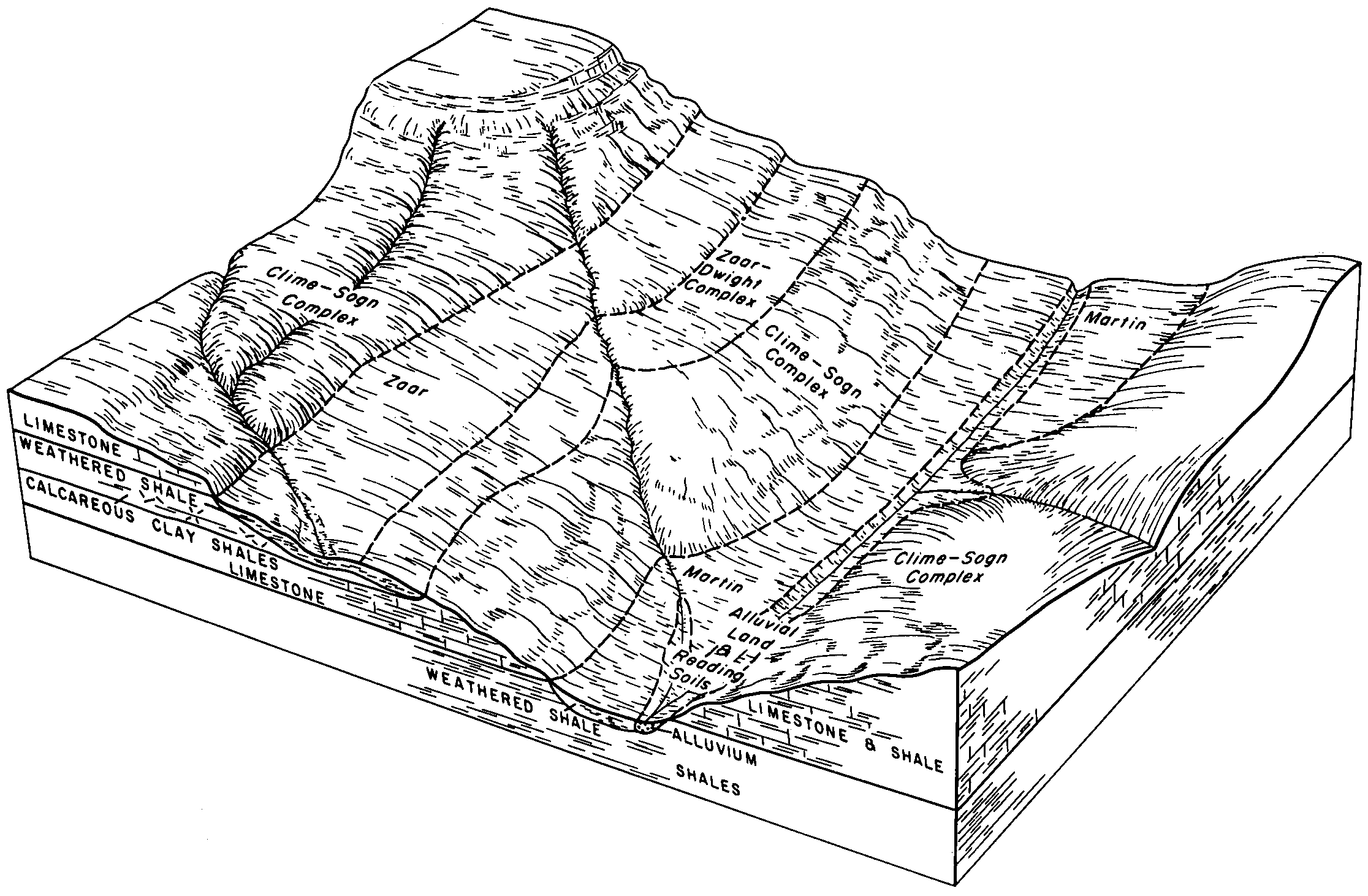
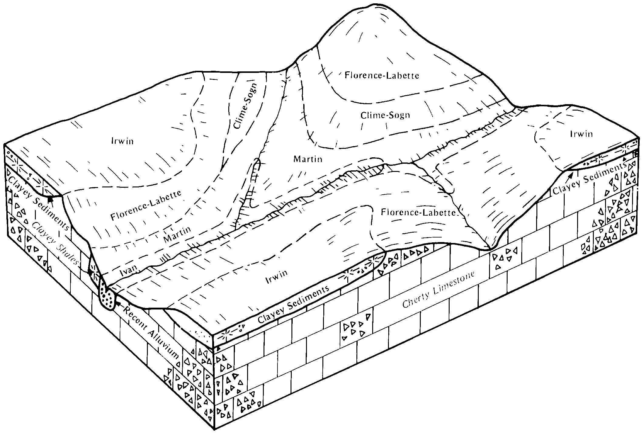
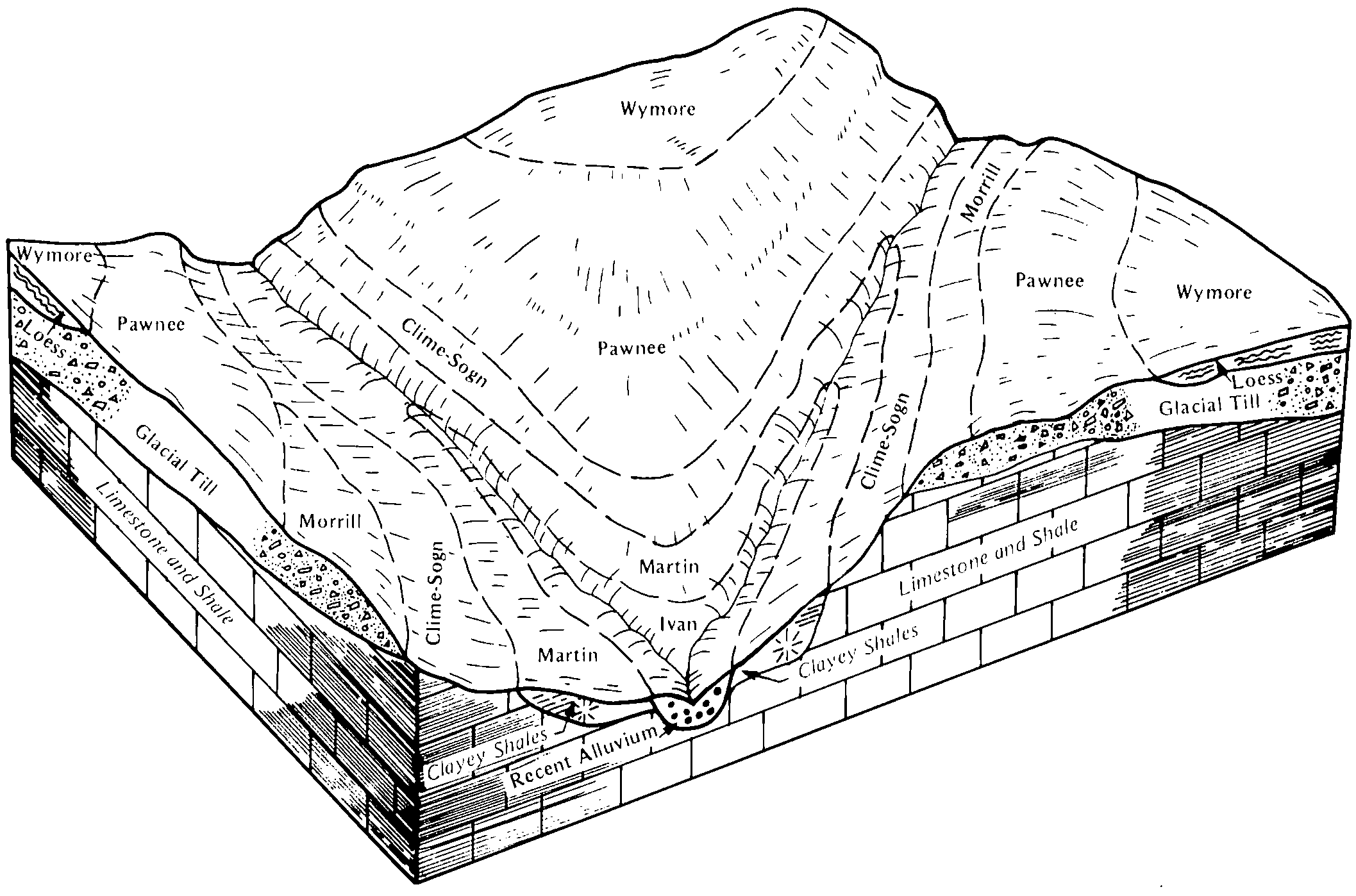
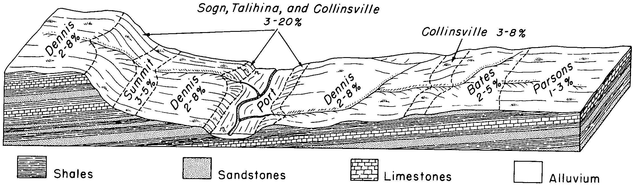
Clime-Sogn complex, 3 to 20 percent slopes | 4590 | 31421 | 2668658 | 1igwo | ks015 | 1970 | 1:24000 |
Sogn silty clay loam, 0 to 10 percent slopes | 4750 | 8569 | 1382903 | 2wvzh | ks015 | 1970 | 1:24000 |
Clime-Sogn complex, 3 to 20 percent slopes | 4590 | 95886 | 2668660 | 1igwo | ks017 | 1967 | 1:24000 |
Labette-Sogn silty clay loam, 0 to 8 percent slopes | 4746 | 59775 | 2733310 | 1igwr | ks017 | 1967 | 1:24000 |
Clime-Sogn complex, 3 to 20 percent slopes | 4590 | 64939 | 2668661 | 1igwo | ks019 | 1972 | 1:24000 |
Sogn silty clay loam, 0 to 10 percent slopes | 4750 | 24306 | 1453371 | 2wvzh | ks019 | 1972 | 1:24000 |
Clareson-Sogn complex, 1 to 3 percent slopes | 8667 | 6314 | 1453400 | 1kscw | ks019 | 1972 | 1:24000 |
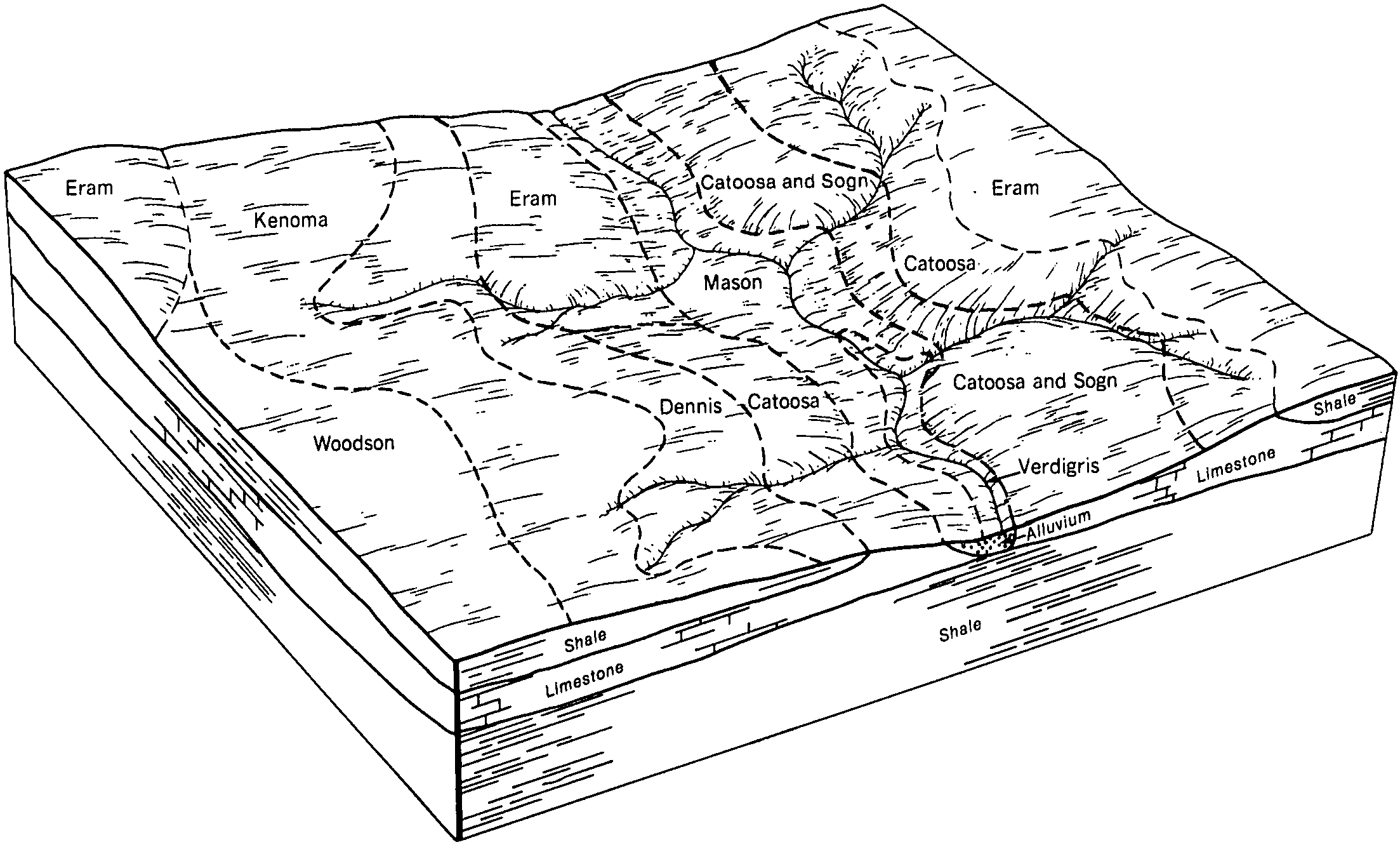
Catoosa-Sogn complex, 0 to 8 percent slopes | 8649 | 231 | 1453398 | 2wty1 | ks019 | 1972 | 1:24000 |
Kipson-Sogn complex, 5 to 30 percent slopes | 4725 | 13704 | 1454661 | 2ww04 | ks027 | 1983 | 1:24000 |
Clime-Sogn complex, 3 to 20 percent slopes | 4590 | 18 | 2668765 | 1igwo | ks027 | 1983 | 1:24000 |
Clime-Sogn complex, 3 to 20 percent slopes | 4590 | 64815 | 2668770 | 1igwo | ks035 | 1977 | 1:24000 |
Labette-Sogn silty clay loam, 0 to 8 percent slopes | 4746 | 59288 | 2733320 | 1igwr | ks035 | 1977 | 1:24000 |
Sogn silty clay loam, 0 to 10 percent slopes | 4750 | 48815 | 1382968 | 2wvzh | ks035 | 1977 | 1:24000 |
Clime-Sogn complex, 3 to 20 percent slopes | 4590 | 25451 | 2668774 | 1igwo | ks041 | 1977 | 1:24000 |
Kipson-Sogn complex, 5 to 30 percent slopes | 4725 | 54 | 1454557 | 2ww04 | ks041 | 1977 | 1:24000 |
Sogn-Vinland complex, 3 to 25 percent slopes | 4752 | 14454 | 1468812 | 2wvzj | ks045 | 1974 | 1:24000 |
Clime-Sogn complex, 3 to 20 percent slopes | 4590 | 64182 | 2668776 | 1igwo | ks049 | 1984 | 1:24000 |
Catoosa-Sogn complex, 0 to 8 percent slopes | 8649 | 23889 | 1453331 | 2wty1 | ks049 | 1984 | 1:24000 |
Labette-Sogn silty clay loam, 0 to 8 percent slopes | 4746 | 15298 | 2733322 | 1igwr | ks049 | 1984 | 1:24000 |
Sogn silty clay loam, 0 to 10 percent slopes | 4750 | 5059 | 1453307 | 2wvzh | ks049 | 1984 | 1:24000 |
Clime-Sogn complex, 3 to 20 percent slopes | 4590 | 49355 | 2668778 | 1igwo | ks061 | 1991 | 1:24000 |
Clime-Sogn complex, 3 to 20 percent slopes | 4590 | 192430 | 2668780 | 1igwo | ks073 | 1981 | 1:24000 |
Labette-Sogn silty clay loam, 0 to 8 percent slopes | 4746 | 45090 | 2733327 | 1igwr | ks073 | 1981 | 1:24000 |
Clime-Sogn complex, 3 to 20 percent slopes | 4590 | 18106 | 2668781 | 1igwo | ks085 | 1976 | 1:24000 |
Vinland-Sogn complex, 5 to 15 percent slopes | 7660 | 7924 | 1480373 | 2wvzl | ks085 | 1976 | 1:24000 |
Sogn-Vinland complex, 3 to 25 percent slopes | 4752 | 950 | 1480329 | 2wvzj | ks085 | 1976 | 1:24000 |
Kipson-Sogn complex, 5 to 30 percent slopes | 4725 | 210 | 1480328 | 2ww04 | ks085 | 1976 | 1:24000 |
Sogn-Vinland complex, 3 to 25 percent slopes | 4752 | 11718 | 1480030 | 2wvzj | ks087 | 1974 | 1:24000 |
Sogn-Vinland complex, 3 to 25 percent slopes | 4752 | 13795 | 766074 | 2wvzj | ks091 | 1976 | 1:24000 |
Gosport-Sogn complex, 7 to 35 percent slopes | 7250 | 8035 | 1862364 | 20hy8 | ks103 | 1973 | 1:24000 |
Knox complex, 18 to 30 percent slopes | 7957 | 2440 | 1862418 | 20j00 | ks103 | 1973 | 1:24000 |
Clime-Sogn complex, 3 to 20 percent slopes | 4590 | 57542 | 2668786 | 1igwo | ks111 | 1977 | 1:24000 |
Labette-Sogn silty clay loam, 0 to 8 percent slopes | 4746 | 20767 | 2733340 | 1igwr | ks115 | 1981 | 1:24000 |
Clime-Sogn complex, 3 to 20 percent slopes | 4590 | 18075 | 2668789 | 1igwo | ks115 | 1981 | 1:24000 |
Sogn silty clay loam, 0 to 10 percent slopes | 4750 | 16606 | 1382795 | 2wvzh | ks115 | 1981 | 1:24000 |
Kipson-Sogn complex, 5 to 30 percent slopes | 4725 | 51022 | 1457070 | 2ww04 | ks117 | 1977 | 1:24000 |
Clime-Sogn complex, 3 to 20 percent slopes | 4590 | 3850 | 2668792 | 1igwo | ks117 | 1977 | 1:24000 |
Clime-Sogn complex, 3 to 20 percent slopes | 4590 | 15992 | 2668798 | 1igwo | ks127 | 1970 | 1:24000 |
Labette-Sogn silty clay loam, 0 to 8 percent slopes | 4746 | 14522 | 2733345 | 1igwr | ks127 | 1970 | 1:24000 |
Kipson-Sogn complex, 5 to 30 percent slopes | 4725 | 10533 | 1454504 | 2ww04 | ks127 | 1970 | 1:24000 |
Kipson-Sogn complex, 5 to 30 percent slopes | 4725 | 223 | 1406006 | 2ww04 | ks131 | 1980 | 1:24000 |
Clime-Sogn complex, 3 to 20 percent slopes | 4590 | 165 | 2668800 | 1igwo | ks131 | 1980 | 1:24000 |
Clime-Sogn complex, 3 to 20 percent slopes | 4590 | 3150 | 2668802 | 1igwo | ks139 | 1983 | 1:24000 |
Sogn-Vinland complex, 3 to 25 percent slopes | 4752 | 2420 | 1454762 | 2wvzj | ks139 | 1983 | 1:24000 |
Vinland-Sogn complex, 15 to 45 percent slopes | 7661 | 167 | 1454780 | 2wvzm | ks139 | 1983 | 1:24000 |
Clime-Sogn complex, 3 to 20 percent slopes | 4590 | 106911 | 2668743 | 1igwo | ks149 | 1984 | 1:24000 |
Kipson-Sogn complex, 5 to 30 percent slopes | 4725 | 311 | 1481071 | 2ww04 | ks149 | 1984 | 1:24000 |
Clime-Sogn complex, 3 to 20 percent slopes | 4590 | 77486 | 2668810 | 1igwo | ks161 | 1970 | 1:24000 |
Kipson-Sogn complex, 5 to 30 percent slopes | 4725 | 1033 | 1472316 | 2ww04 | ks161 | 1970 | 1:24000 |
Sogn-Vinland complex, 3 to 25 percent slopes | 4752 | 30534 | 1473462 | 2wvzj | ks177 | 1966 | 1:24000 |
Kipson-Sogn complex, 5 to 30 percent slopes | 4725 | 1392 | 1473458 | 2ww04 | ks177 | 1966 | 1:24000 |
Vinland-Sogn complex, 15 to 45 percent slopes | 7661 | 239 | 1532315 | 2wvzm | ks177 | 1966 | 1:24000 |
Clime-Sogn complex, 3 to 20 percent slopes | 4590 | 139972 | 2668821 | 1igwo | ks197 | 1988 | 1:24000 |
Sogn-Vinland complex, 3 to 25 percent slopes | 4752 | 69 | 1472148 | 2wvzj | ks197 | 1988 | 1:24000 |
Kipson-Sogn complex, 5 to 30 percent slopes | 4725 | 16818 | 1454887 | 2ww04 | ks201 | 1988 | 1:24000 |
Clime-Sogn complex, 3 to 20 percent slopes | 4590 | 1020 | 2668825 | 1igwo | ks205 | 1985 | 1:20000 |
Ringo-Sogn complex, 5 to 15 percent slopes | 8877 | 7906 | 1427205 | 2wwds | ks207 | 1973 | 1:20000 |
Clareson-Sogn complex, 1 to 8 percent slopes | 8669 | 2505 | 1427182 | 2ydvc | ks207 | 1973 | 1:20000 |
Clime-Sogn complex, 3 to 20 percent slopes | 4590 | 1123 | 2668827 | 1igwo | ks207 | 1973 | 1:20000 |
Gosport-Sogn complex, 7 to 35 percent slopes | 7250 | 6487 | 1862252 | 20htn | ks209 | 1973 | 1:24000 |
Knox complex, 18 to 30 percent slopes | 7957 | 4642 | 1862306 | 20hwd | ks209 | 1973 | 1:24000 |
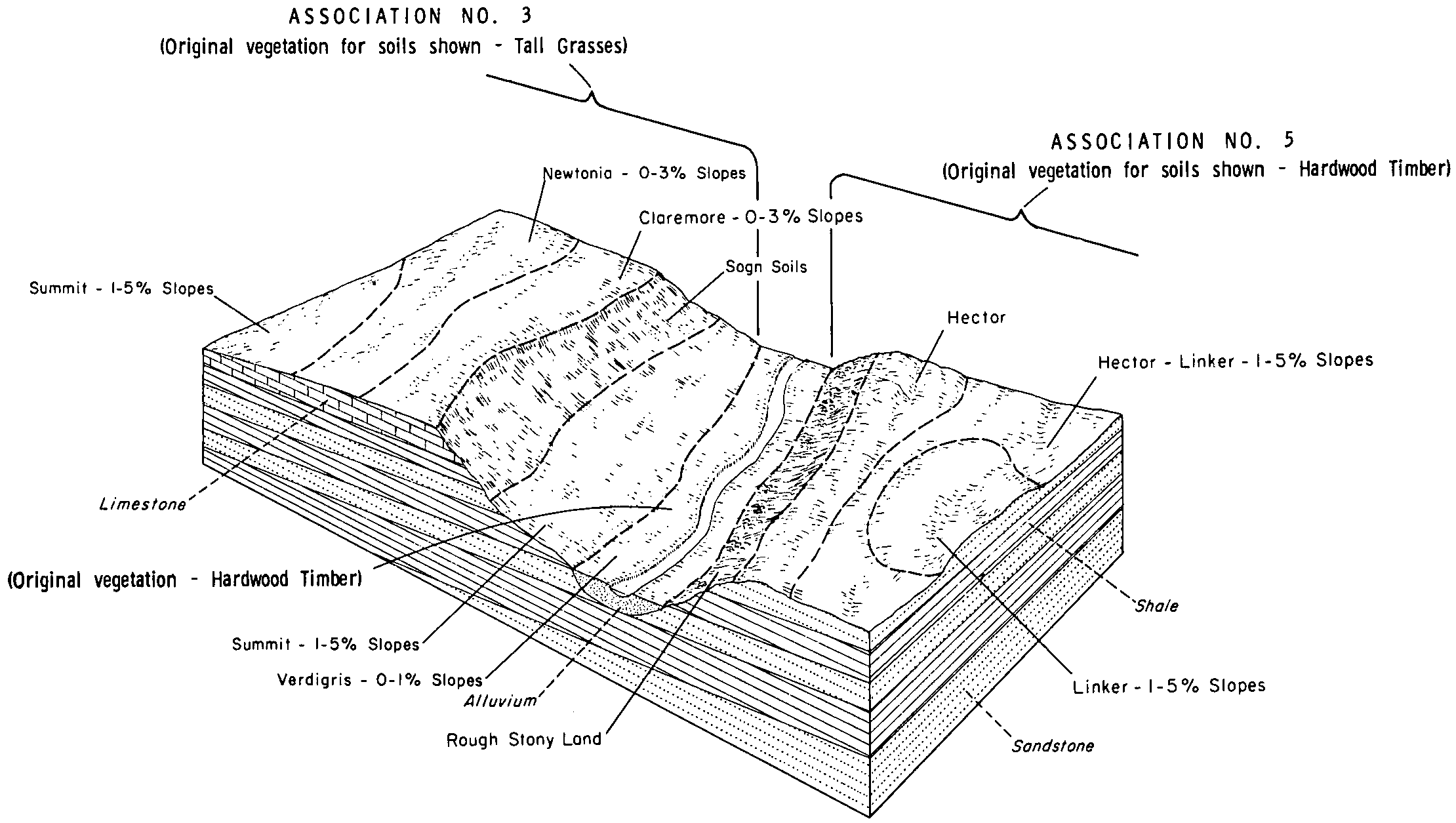
Sogn silt loam, 2 to 12 percent slopes | 11C | 188 | 398220 | fcct | mn055 | 1981 | 1:15840 |
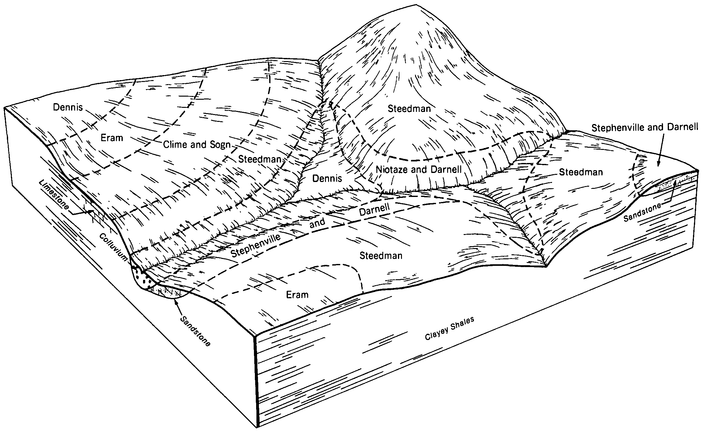
Brodale-Sogn complex, 12 to 25 percent slopes | 973D | 1643 | 400820 | fg2p | mn109 | 1977 | 1:15840 |
Sogn loam, 4 to 12 percent slopes | 11C | 1304 | 400710 | ffz4 | mn109 | 1977 | 1:15840 |
Sogn silt loam, rocky, 6 to 30 percent slopes | 11D | 1714 | 428991 | gddf | mn169 | 1987 | 1:20000 |
Spinks-Boone-Sogn complex, rocky, 15 to 60 percent slopes | 831F | 978 | 429096 | gdht | mn169 | 1987 | 1:20000 |
Sogn silt loam, 1 to 6 percent slopes | 11B | 473 | 428990 | gddd | mn169 | 1987 | 1:20000 |
Sogn-Rock Outcrop complex, 11 to 30 percent slopes | 3921 | 1933 | 1691503 | 2vhh7 | ne025 | 1981 | 1:20000 |
Kipson-Sogn complex, 3 to 30 percent slopes | 4166 | 2783 | 1691109 | 2wvzx | ne067 | 2000 | 1:12000 |
Kipson-Sogn-Rock Outcrop complex, 11 to 60 percent slopes | 4167 | 1627 | 1691110 | 2wvzy | ne067 | 2000 | 1:12000 |
Sogn-Rock Outcrop complex, 11 to 30 percent slopes | 3921 | 102 | 1691388 | 2vhh7 | ne109 | 1977 | 1:20000 |
Sogn-Kipson complex, 7 to 30 percent slopes | 3920 | 1451 | 1691699 | 2vhh6 | ne127 | 1983 | 1:20000 |
Sogn-Rock Outcrop complex, 11 to 30 percent slopes | 3921 | 12 | 2219327 | 2vhh7 | ne131 | 1979 | 1:20000 |
Kipson-Sogn complex, 3 to 30 percent slopes | 4166 | 3722 | 1691618 | 2wvzx | ne133 | 1969 | 1:15840 |
Kipson-Sogn complex, 3 to 30 percent slopes | 4166 | 11358 | 1691044 | 2wvzx | ne147 | 1967 | 1:20000 |
Hedville, Sogn, and Contrary soils, 12 to 75 percent slopes | 4113 | 372 | 1711010 | 1vffw | ne153 | 2007 | 1:12000 |
Sogn silty clay loam, 1 to 12 percent slopes | So | 1904 | 571798 | m603 | ok001 | 1963 | 1:24000 |
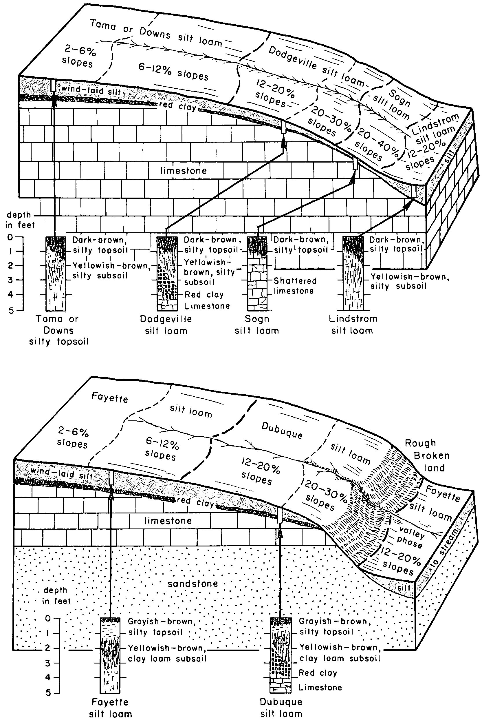
Sogn silt loam, 2 to 20 percent slopes | 164C | 6626 | 753588 | t959 | wi025 | 1972 | 1:15840 |
Sogn silt loam, 20 to 35 percent slopes | 164E | 2407 | 753589 | t95b | wi025 | 1972 | 1:15840 |
Sogn stony silt loam, 0 to 6 percent slopes | 164B | 208 | 425566 | g8ty | wi039 | 1967 | 1:15840 |
Sogn silt loam, 15 to 20 percent slopes, moderately eroded | 164D2 | 7077 | 424337 | g7k9 | wi043 | 1959 | 1:20000 |
Sogn silt loam, 10 to 15 percent slopes, moderately eroded | 164C2 | 2484 | 424335 | g7k7 | wi043 | 1959 | 1:20000 |
Sogn loam, 15 to 20 percent slopes, moderately eroded | 160D2 | 836 | 424332 | g7k4 | wi043 | 1959 | 1:20000 |
Sogn loam, 10 to 15 percent slopes, moderately eroded | 160C2 | 467 | 424331 | g7k3 | wi043 | 1959 | 1:20000 |
Sogn silt loam, 2 to 10 percent slopes, moderately eroded | 164B2 | 325 | 424333 | g7k5 | wi043 | 1959 | 1:20000 |
Sogn silt loam, 12 to 30 percent slopes, moderately eroded | 164E2 | 14388 | 1591203 | 1qds4 | wi045 | 1969 | 1:12000 |
Sogn silt loam, 2 to 12 percent slopes, moderately eroded | 164C2 | 4955 | 1591202 | 1qds3 | wi045 | 1969 | 1:12000 |
Sogn and Dodgeville silt loams, shallow, 12 to 20 percent slopes, moderately eroded | 1164D2 | 10245 | 424708 | g7y8 | wi049 | 1960 | 1:20000 |
Sogn and Dodgeville silt loams, shallow, 6 to 12 percent slopes, moderately eroded | 1164C2 | 2885 | 424706 | g7y6 | wi049 | 1960 | 1:20000 |
Sogn and Dodgeville silt loams, shallow, 20 to 30 percent slopes, moderately eroded | 1164E2 | 1432 | 424710 | g7yb | wi049 | 1960 | 1:20000 |
Sogn and Dodgeville silt loams, shallow, 2 to 6 percent slopes, moderately eroded | 1164B2 | 429 | 424704 | g7y4 | wi049 | 1960 | 1:20000 |
Sogn silt loam, 12 to 20 percent slopes, moderately eroded | 164D2 | 11941 | 424895 | g849 | wi065 | 1964 | 1:15840 |
Sogn silt loam, 20 to 30 percent slopes, moderately eroded | 164E2 | 1783 | 1454745 | 1kts8 | wi065 | 1964 | 1:15840 |
Sogn silt loam, 2 to 12 percent slopes, moderately eroded | 164C2 | 1472 | 424893 | g847 | wi065 | 1964 | 1:15840 |
Sogn silt loam, 30 to 45 percent slopes | 164F | 508 | 424897 | g84c | wi065 | 1964 | 1:15840 |
Sogn loam, 12 to 20 percent slopes | 160D | 1446 | 426393 | g9pm | wi105 | 1970 | 1:20000 |
Sogn loam, 6 to 12 percent slopes, eroded | 160C2 | 1377 | 426392 | g9pl | wi105 | 1970 | 1:20000 |
Sogn loam, 2 to 6 percent slopes | 160B | 742 | 426391 | g9pk | wi105 | 1970 | 1:20000 |
Sogn loam, 30 to 45 percent slopes | 160F | 176 | 426394 | g9pn | wi105 | 1970 | 1:20000 |