Flintsteel (50%)
Loamy Uplands
Oxyaquic Glossudalfs
Moderately well drained
Hydric: No
PAWS: 25 cm |
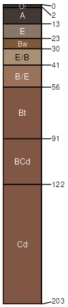
till plains / Summit till plains / Shoulder till plains / Backslope till plains / Footslope till plains / Toeslope
|
|
Watton (20%)
Loamy Uplands
Typic Glossudalfs
Well drained
Hydric: No
PAWS: 25 cm |
till plains / Summit till plains / Shoulder till plains / Backslope till plains / Footslope till plains / Toeslope
|
|
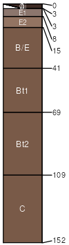
Gull Point (15%)
Wet Floodplains
Typic Argiaquolls
Poorly drained
Hydric: Yes
PAWS: 33 cm |

till plains / Toeslope flood plains / Toeslope
|
|
Rockland (5%)
Loamy Uplands
Typic Eutrudepts
Well drained
Hydric: No
PAWS: 40 cm |
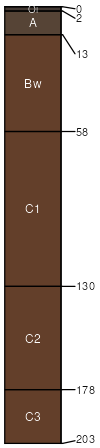
slumps / Summit slumps / Shoulder slumps / Backslope slumps / Footslope slumps / Toeslope
|
|
Ubly (5%)
Loamy Uplands
Alfic Haplorthods
Well drained
Hydric: No
PAWS: 36 cm |
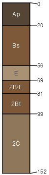
till plains / Summit till plains / Shoulder till plains / Backslope till plains / Footslope till plains / Toeslope
|
|
|
