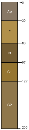
Tinton loamy sand, 2 to 5 percent slopes
Tinton
(80%)
Well Drained Coarse-Loamy Upland
Arenic Hapludults
Well drained
Hydric: No
PAWS: 19 cm
interfluves / Summit
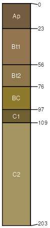
Collington
(10%)
Well Drained Fine-Loamy Upland
Hydric: No
PAWS: NA
interfluves / Summit
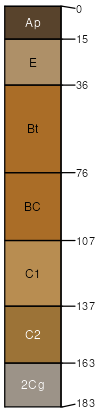
Cedartown
(5%)
Sandy, Excessively Drained Upland
Hydric: No
PAWS: NA
depressions
drainageways
swales
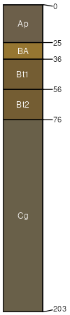
Adelphia
(5%)
Moist Loamy Upland
Aquic Hapludults
Hydric: No
PAWS: 30 cm
depressions
drainageways
swales
SSA
Scale
Published
Export
md003
1:12,000
2003
2025-09-09