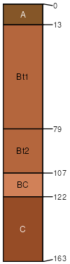
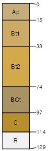
Georgeville (85%)
Acidic upland forest, moist
Typic Kanhapludults
Well drained
Hydric: No
PAWS: 35 cm |
interfluves / Backslope interfluves / Summit interfluves / Shoulder
|
|
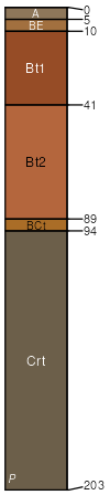
Badin (5%)
Typic Hapludults
Well drained
Hydric: No
PAWS: 11 cm |
|
|
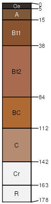
Tatum (4%)
Typic Hapludults
Well drained
Hydric: No
PAWS: 14 cm |
|
|
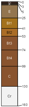
Nason (3%)
Typic Hapludults
Well drained
Hydric: No
PAWS: 15 cm |
|
|
Kirksey (3%)
Aquic Hapludults
Moderately well drained
Hydric: No
PAWS: 21 cm |
|
|