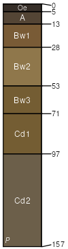
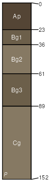
Charlton (55%)
Well Drained Till Uplands
Typic Dystrudepts
Well drained
Hydric: No
PAWS: 24 cm |
hills / Summit hills / Shoulder hills / Backslope
|
|
|
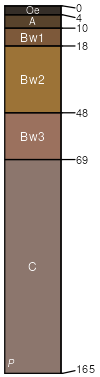
Hollis (5%)
Lithic Dystrudepts
Somewhat excessively drained
Hydric: No
PAWS: 7 cm |
ridges / Summit ridges / Shoulder ridges / Backslope
|
|
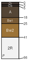
Rock outcrop (5%)
Hydric: No
PAWS: 0 cm |

|
|
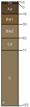
Ridgebury (3%)
Aeric Endoaquepts
Somewhat poorly drained
Hydric: No
PAWS: 21 cm |
|
|
Alden (2%)
Typic Humaquepts
Very poorly drained
Hydric: Yes
PAWS: 23 cm |
|
|