Talala and Foyil soils, 0 to 12 percent slopes
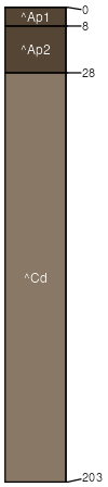
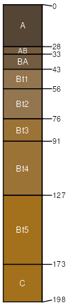
Talala
(70%)
Mined Land
Anthrodensic Udorthents
Well drained
Hydric: No
PAWS: 9 cm
hillslopes / Backslope
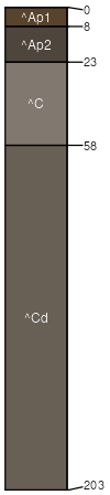
Foyil
(15%)
Mined Land
Anthrodensic Udorthents
Well drained
Hydric: No
PAWS: 11 cm
hillslopes / Backslope
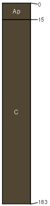
Kanima
(5%)
Mined Land
Anthroportic Udorthents
Well drained
Hydric: No
PAWS: 12 cm
hillslopes / Backslope
Claremore
(5%)
Shallow Limestone Upland
Lithic Argiudolls
Well drained
Hydric: No
PAWS: 10 cm
hillslopes / Shoulder
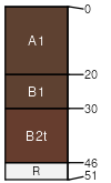
Dennis
(5%)
Loamy Upland
Aquic Argiudolls
Somewhat poorly drained
Hydric: No
PAWS: 32 cm
hillslopes / Backslope
SSA
Scale
Published
Export
ok131
1:24,000
1963
2025-08-29