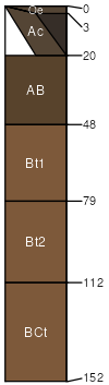
Buckpeak silt loam, 8 to 30 percent slopes
Buckpeak
(100%)
Puget Lowlands Moist Forest
Xeric Palehumults
Well drained
Hydric: No
PAWS: 30 cm
hillslopes
ridges
SSA
Scale
Published
Export
wa641
1:24,000
1980
2025-08-28