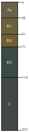
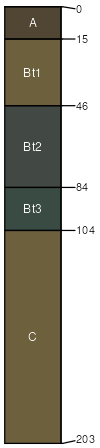
Marlton sandy loam, 5 to 10 percent slopes, severely eroded
Marlton
(80%)
Moist Glauconitic Clayey Upland
Aquic Hapludults
Well drained
Hydric: No
PAWS: 20 cm
knolls
hillslopes / Backslope
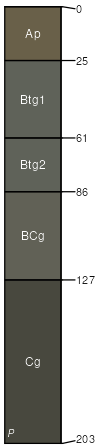
Colemantown
(5%)
Clayey, Glauconitic Coastal Plain Hardwood Swamp
Typic Albaquults
Poorly drained
Hydric: Yes
PAWS: 41 cm
flats / Toeslope
depressions / Toeslope
drainageways
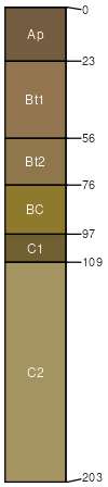
Collington
(5%)
Well Drained Fine-Loamy Upland
Typic Hapludults
Well drained
Hydric: No
PAWS: 24 cm
low hills
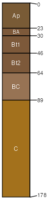
Freehold
(5%)
Well Drained Fine-Loamy Upland
Typic Hapludults
Well drained
Hydric: No
PAWS: 26 cm
low hills
Kresson
(5%)
Moist Glauconitic Clayey Upland
Aquic Hapludults
Somewhat poorly drained
Hydric: No
PAWS: 33 cm
depressions / Toeslope
SSA
Scale
Published
Export
nj007
1:12,000
1964
2025-08-28