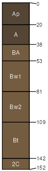
Mershon silt loam, 0 to 8 percent slopes
Mershon
(90%)
Glaciated Middle Cascades Mesic Udic Forest Group
Typic Haplumbrepts
Moderately well drained
Hydric: No
PAWS: 29 cm
hillslopes / Summit
SSA
Scale
Published
Export
or051
1:20,000
1977
2025-09-09