Tongue River-Inchau-Farlow variant complex, 10 to 30 percent slopes
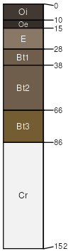
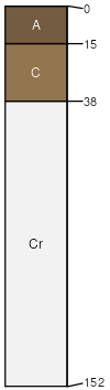
Tongue River
(45%)
Steep Loamy High Mountains
Eutric Haplocryalfs
Well drained
Hydric: No
PAWS: 10 cm
mountain slopes
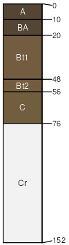
Inchau
(40%)
Subirrigated High Mountains
Ustic Argicryolls
Well drained
Hydric: No
PAWS: 10 cm
mountain slopes
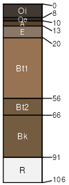
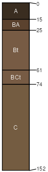
Burnette
(4%)
Loamy (Ly) 15-19 Foothills and Mountains East Precipitation Zone
Pachic Argicryolls
Well drained
Hydric: No
PAWS: 25 cm
mountain valleys
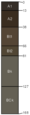
Cloud Peak
(4%)
Ustic Haplocryalfs
Well drained
Hydric: No
PAWS: 4 cm
mountain valleys
Roxal
(4%)
Shallow Loamy (SwLy) 15-19 Foothills and Mountains East Precipitation Zone
Typic Cryorthents
Well drained
Hydric: No
PAWS: 7 cm
ridges
Youga
(3%)
Loamy (Ly) 15-19 Foothills and Mountains East Precipitation Zone
Ustic Argicryolls
Well drained
Hydric: No
PAWS: 21 cm
mountain slopes
SSA
Scale
Published
Export
wy713
1:24,000
1986
2025-09-04