Shingle-Samday complex, 3 to 45 percent slopes
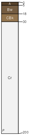
Shingle
(45%)
Shallow Loamy High Plains Southeast (SwLy)
Ustic Torriorthents
Well drained
Hydric: No
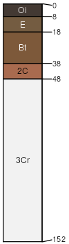
PAWS: 8 cm
hillslopes / Backslope
hillslopes / Shoulder
hillslopes / Summit
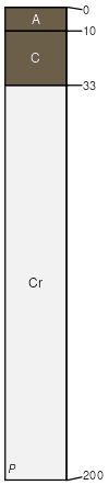
Samday
(35%)
Shale High Plains Southeast (Sh)
Ustic Torriorthents
Well drained
Hydric: No
PAWS: 7 cm
hills / Backslope
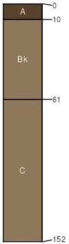
Kishona
(10%)
Loamy High Plains Southeast (Ly)
Ustic Torriorthents
Well drained
Hydric: No
PAWS: 36 cm
fan remnants
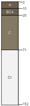
Theedle
(5%)
Loamy High Plains Southeast (Ly)
Ustic Torriorthents
Well drained
Hydric: No
PAWS: 14 cm
hills
Gateridge
(3%)
Shallow Loamy (SwLy) 10-14 PZ
Aridic Haplustalfs
Well drained
Hydric: No
PAWS: 7 cm
hills / Backslope
Rock outcrop
(2%)
Hydric:
PAWS: NA
hills / Backslope
hills / Shoulder
SSA
Scale
Published
Export
wy625
1:24,000
1985
2025-09-04