Styers-Ironsprings-Maysprings complex, 10 to 20 percent slopes
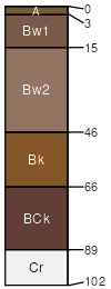
Styers
(45%)
Dense Clay Foothills and Basins West (DC)
Udorthentic Chromusterts
Well drained
Hydric: No
PAWS: 13 cm
hills / Footslope
hills / Backslope
hills / Summit
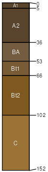
Ironsprings
(25%)
Sandy Land
Aridic Argiborolls
Somewhat excessively drained
Hydric: No
PAWS: 12 cm
hills / Footslope
hills / Backslope
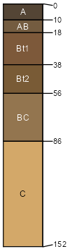
Maysprings
(15%)
Sandy Land
Borollic Haplargids
Well drained
Hydric: No
PAWS: 12 cm
hills / Backslope
hills / Summit
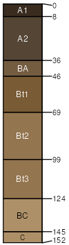
Berlake
(8%)
Hydric:
PAWS: NA
hills / Footslope
hills / Backslope
Gretivid
(7%)
Hydric: No
PAWS: NA
hills / Summit
SSA
Scale
Published
Export
co686
1:32,000
1992
2025-09-19