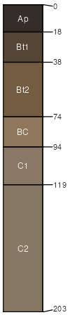
Bygland silt loam, map >25, 0 to 2 percent slopes
Bygland
(85%)
Clayey Upland
Oxyaquic Vertic Argiudolls
Moderately well drained
Hydric: No
PAWS: 38 cm
lake plains
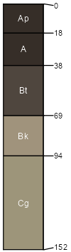
Lindaas
(10%)
Hydric: Yes
PAWS: NA
swales
Lindaas
(5%)
Hydric: Yes
PAWS: NA
swales
SSA
Scale
Published
Export
mn171
1:12,000
1998
2025-09-10