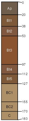
Westville loam, 2 to 6 percent slopes, eroded
Westville
(100%)
Loamy and Clayey Upland
Typic Hapludalfs
Well drained
Hydric: No
PAWS: 27 cm
till plains / Summit
moraines / Summit
SSA
Scale
Published
Export
wi105
1:20,000
1970
2025-09-10