Tamford (50%)
Claypan Upland (South)
Chromic Udic Haplusterts
Well drained
Hydric: No
PAWS: 28 cm |
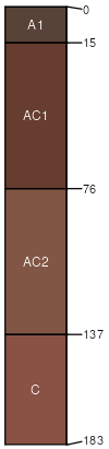
hills hillslopes / Backslope
|
|
Grainola (40%)
Claypan Upland (South)
Udertic Haplustalfs
Well drained
Hydric: No
PAWS: 15 cm |
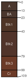
hills hillslopes / Backslope
|
|
Chickasha (5%)
Loamy Upland
Udic Argiustolls
Well drained
Hydric: No
PAWS: 19 cm |
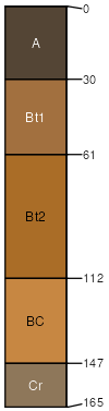
hills hillslopes / Backslope
|
|
Masham (5%)
Shallow Clay Upland
Udic Haplustepts
Well drained
Hydric: No
PAWS: 7 cm |
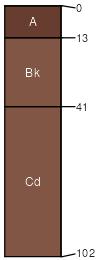
hillslopes / Backslope hills
|
|