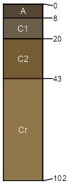
Cohagen (35%)
Shallow Sandy
Typic Ustorthents
Well drained
Hydric: No
PAWS: 4 cm |
ridges / Summit ridges / Shoulder hills / Summit hills / Shoulder
|
|
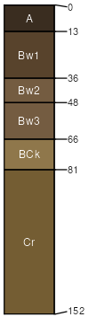
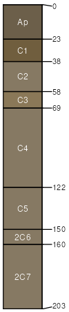
Vebar (30%)
Sandy
Typic Haploborolls
Well drained
Hydric: No
PAWS: 12 cm |
|
|
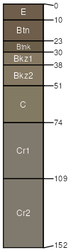
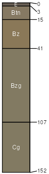
Bullock (20%)
Thin Claypan
Borollic Natrargids
Well drained
Hydric: No
PAWS: 7 cm |
hills / Backslope hills / Footslope plains / Backslope plains / Footslope
|
|
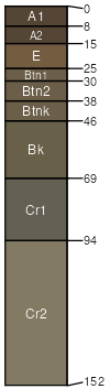
Parchin (5%)
Claypan
Borollic Natrargids
Well drained
Hydric: No
PAWS: 8 cm |
plains / Backslope plains / Footslope
|
|
Trembles (4%)
Loamy Overflow
Typic Ustifluvents
Well drained
Hydric: No
PAWS: 18 cm |
|
|
Glenross (4%)
Saline Lowland
Typic Natraqualfs
Poorly drained
Hydric: Yes
PAWS: 21 cm |
drainageways / Footslope drainageways / Toeslope
|
|
Rock outcrop (1%)
Non-site
Excessively drained
Hydric: No
PAWS: 6 cm |

hills / Summit hills / Shoulder ridges / Summit ridges / Shoulder
|
|
Slickspots (1%)
Non-site
Well drained
Hydric: No
PAWS: 9 cm |
hills / Summit hills / Backslope hills / Footslope
|
|