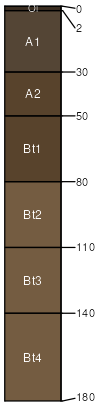
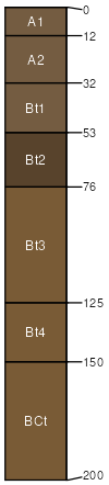
Sproulish (45%)
Dry, steep mountain slopes
Typic Dystrustepts
Well drained
Hydric: No
PAWS: 19 cm |

mountain slopes / Backslope ridges / Summit ridges / Shoulder
|
|
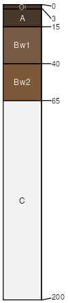
Canoecreek (20%)
Dry, steep mountain slopes
Andic Haplustepts
Well drained
Hydric: No
PAWS: 18 cm |
mountain slopes / Backslope ridges / Summit ridges / Shoulder
|
|
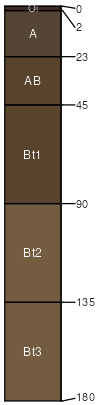
Redwohly (20%)
Dry, steep mountain slopes
Ultic Haplustalfs
Well drained
Hydric: No
PAWS: 13 cm |
ridges / Summit ridges / Shoulder mountain slopes / Shoulder mountain slopes / Backslope
|
|
|
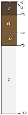
Briceland (5%)
Fine-loamy Uplands
Aquic Palexeralfs
Moderately well drained
Hydric: No
PAWS: 30 cm |
mountain slopes / Backslope
|
|
|
Rock outcrop (2%)
Hydric: No
PAWS: NA |

mountain slopes / Backslope
|
|