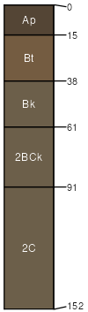
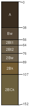
Dooley (35%)
Sandy
Typic Argiustolls
Well drained
Hydric: No
PAWS: 24 cm |
ridges / Summit ridges / Backslope
|
|
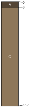
Lihen (21%)
Sands
Entic Haplustolls
Well drained
Hydric: No
PAWS: 15 cm |
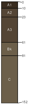
hills / Backslope hills / Footslope ridges
|
|
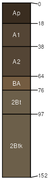
Zahl (18%)
Thin Loamy
Typic Calciustolls
Well drained
Hydric: No
PAWS: 26 cm |
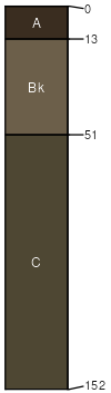
hills / Summit hills / Shoulder ridges / Summit ridges / Shoulder
|
|
Parshall (13%)
Sandy
Pachic Haplustolls
Well drained
Hydric: No
PAWS: 22 cm |
|
|
Blanchard (5%)
Sands
Typic Ustipsamments
Excessively drained
Hydric: No
PAWS: 12 cm |
knolls / Shoulder hills / Shoulder
|
|
Flaxton (5%)
Sandy
Pachic Argiustolls
Well drained
Hydric: No
PAWS: 25 cm |
|
|
Krem (3%)
Sands
Typic Paleustolls
Well drained
Hydric: No
PAWS: 21 cm |
|
|