Urban land-Chatfield complex, rocky, 3 to 15 percent slopes
Urban land
(45%)
Hydric: Unranked
PAWS: 0 cm
ridges
hills
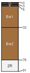
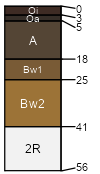
Chatfield
(30%)
Well Drained Till Uplands
Typic Dystrudepts
Well drained
Hydric: No
PAWS: 8 cm
ridges
hills
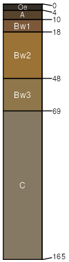
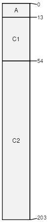
Charlton
(5%)
Typic Dystrudepts
Well drained
Hydric: No
PAWS: 16 cm
hills
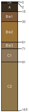
Sutton
(5%)
Aquic Dystrudepts
Moderately well drained
Hydric: No
PAWS: 19 cm
drainageways
depressions
Leicester
(5%)
Aeric Endoaquepts
Poorly drained
Hydric: Yes
PAWS: 19 cm
drainageways
depressions
Hollis
(5%)
Lithic Dystrudepts
Somewhat excessively drained
Hydric: No
PAWS: 5 cm
ridges
hills
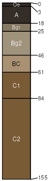
Udorthents
(3%)
Moderately well drained
Hydric: No
PAWS: 23 cm
Rock outcrop
(2%)
Hydric: No
PAWS: NA
SSA
Scale
Published
Export
ct601
1:12,000
2003
2025-09-16