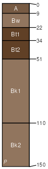
Wineg fine sandy loam, 0 to 3 percent slopes
Wineg
(95%)
Loamy Upland 10-14 p.z.
Ustic Calciargids
Well drained
Hydric: No
PAWS: 22 cm
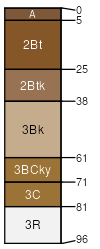
flood plains / Toeslope
Sanostee
(5%)
Hydric: No
PAWS: NA
SSA
Scale
Published
Export
az631
1:24,000
1980
2025-08-26