Rock Reservoir-Stonebarn-Whistlecreek complex, 1 to 5 percent slopes, frequently flooded
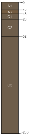
Rock Reservoir
(35%)
Saline Lowland (SL) Big Horn Basin Wet
Aeric Fluvaquents
Very poorly drained
Hydric: Yes
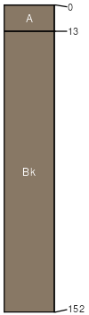
PAWS: 21 cm
flood plains
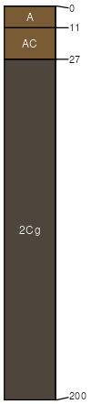
Stonebarn
(30%)
Saline Subirrigated (SS) Big Horn Basin Wet
Typic Endoaquents
Poorly drained
Hydric: Yes
PAWS: 10 cm
flood plains
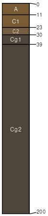
Whistlecreek
(20%)
Wetland (WL) Big Horn Basin Wet
Typic Fluvaquents
Poorly drained
Hydric: Yes
PAWS: 18 cm
flood plains
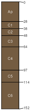
Green River
(10%)
Saline Lowland (SL) Big Horn Basin Wet
Oxyaquic Torrifluvents
Moderately well drained
Hydric: Yes
PAWS: 13 cm
flood plains
Tipperary
(5%)
Overflow (Ov) Big Horn Basin Wet
Typic Torripsamments
Somewhat excessively drained
Hydric: No
PAWS: 10 cm
flood plains
SSA
Scale
Published
Export
wy603
1:24,000
2025-09-04