Slipperyjim-Belleplain, extremely flaggy surface, association, 0 to 15 percent slopes
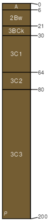
Slipperyjim
(45%)
Saline Lowland Drained Green River and Great Divide Basins (SLDr)
Sodic Ustic Haplocambids
Well drained
Hydric: No
PAWS: 34 cm
alluvial flats
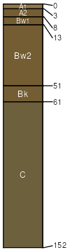
Belleplain
(35%)
Gravelly Green River and Great Divide Basins (Gr)
Ustic Haplocambids
Well drained
Hydric: No
PAWS: 15 cm
alluvial fans
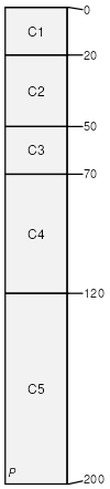
Shellcreek
(13%)
Saline Lowland Drained Green River and Great Divide Basins (SLDr)
Ustertic Haplocambids
Well drained
Hydric: No
PAWS: 33 cm
alluvial flats
Shellcreek taxadjunct
(5%)
Saline Lowland Drained Green River and Great Divide Basins (SLDr)
Sodic Endoaquents
Very poorly drained
Hydric: Yes
PAWS: 34 cm
alluvial flats
Water
(2%)
Hydric: Unranked
PAWS: NA
SSA
Scale
Published
Export
wy737
1:24,000
2025-09-04