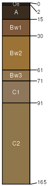
Charlton (40%)
Well Drained Till Uplands
Typic Dystrudepts
Well drained
Hydric: No
PAWS: 19 cm |
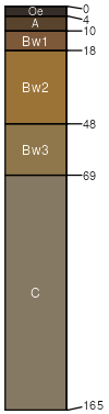
hills / Summit hills / Shoulder hills / Backslope
|
|
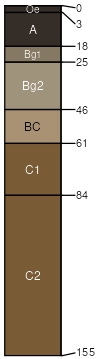
Urban land (35%)
Hydric: Unranked
PAWS: 0 cm |

|
|
Chatfield (10%)
Typic Dystrudepts
Well drained
Hydric: No
PAWS: 12 cm |
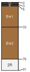
ridges / Summit ridges / Shoulder ridges / Backslope
|
|
Udorthents (5%)
Well drained
Hydric: No
PAWS: 31 cm |
|
|
Leicester (5%)
Aeric Endoaquepts
Poorly drained
Hydric: Yes
PAWS: 25 cm |
|
|
Sutton (5%)
Aquic Dystrudepts
Moderately well drained
Hydric: No
PAWS: 23 cm |
|
|