Bouldercreek, high precipitation-Marblecreek association, 25 to 65 percent slopes
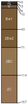
Bouldercreek
(50%)
Ashy Hills and Mountains 30-45 PZ Frigid Western Bitterroot Foothills
Typic Udivitrands
Well drained
Hydric: No
PAWS: 13 cm
mountain slopes
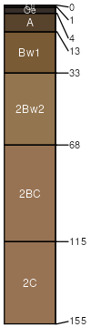
Marblecreek
(30%)
Dry Ashy Hills and Mountains 30-45 PZ Frigid Clearwater Mountains
Andic Eutrudepts
Well drained
Hydric: No
PAWS: 13 cm
mountain slopes
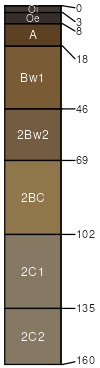
Flewsie
(5%)
Typic Udivitrands
Well drained
Hydric: No
PAWS: 23 cm
mountain slopes
Nakarna
(5%)
Typic Udivitrands
Well drained
Hydric: No
PAWS: 21 cm
mountain slopes
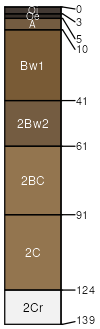
Rock outcrop
(5%)
Hydric: No
PAWS: NA
Rubble land
(5%)
Hydric: No
PAWS: NA
SSA
Scale
Published
Export
id670
1:24,000
2025-08-27