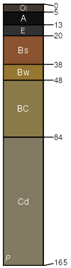
Monadnock (45%)
Loamy over Sandy
Typic Haplorthods
Well drained
Hydric: No
PAWS: 20 cm |
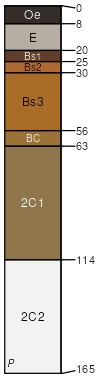
hills / Summit hills / Shoulder hills / Backslope mountains
|
|
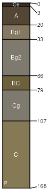
Lyman (25%)
Shallow and Moderately-deep Till
Lithic Haplorthods
Somewhat excessively drained
Hydric: No
PAWS: 9 cm |
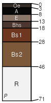
hills / Summit hills / Shoulder hills / Backslope mountains
|
|
Rock outcrop (15%)
Rockland (reserved)
Hydric: Unranked
PAWS: NA |

hills / Summit hills / Shoulder hills / Backslope mountains
|
|
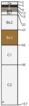
Tunbridge (4%)
Typic Haplorthods
Well drained
Hydric: No
PAWS: 16 cm |
hills / Summit hills / Shoulder hills / Backslope mountains
|
|
Sunapee (4%)
Aquic Haplorthods
Moderately well drained
Hydric: No
PAWS: 21 cm |
hills / Backslope hills / Footslope mountains
|
|
Marlow (4%)
Oxyaquic Haplorthods
Well drained
Hydric: No
PAWS: 17 cm |
mountains hills / Summit hills / Shoulder hills / Backslope
|
|
Lyme (3%)
Aeric Endoaquepts
Poorly drained
Hydric: Yes
PAWS: 22 cm |
hills / Footslope hills / Toeslope mountains
|
|