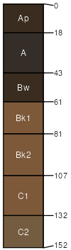
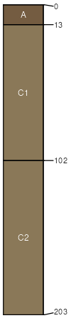
St. Onge loam, 0 to 2 percent slopes, rarely flooded
St. Onge
(80%)
Overflow
Cumulic Haplustolls
Well drained
Hydric: No
PAWS: 28 cm
stream terraces / Footslope
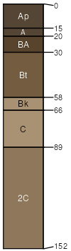
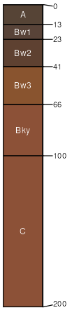
Altvan
(4%)
Loamy-North (18-22 PZ)
Typic Argiustolls
Well drained
Hydric: No
PAWS: 16 cm
terraces / Footslope
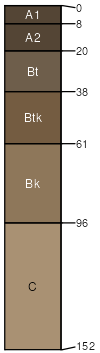
Thirtynine
(4%)
Loamy-North (18-22 PZ)
Typic Argiustolls
Well drained
Hydric: No
PAWS: 26 cm
terraces / Summit
terraces / Backslope
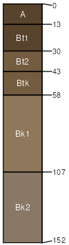
Recluse
(4%)
Loamy-North (18-22 PZ)
Aridic Argiustolls
Well drained
Hydric: No
PAWS: 24 cm
alluvial fans
fan remnants
Sodawells
(4%)
Saline Lowland (SL) 15-19 Precipitation Zone, Black Hills
Aridic Ustifluvents
Well drained
Hydric: No
PAWS: 18 cm
flood plains / Toeslope
Tilford
(3%)
Loamy-North (18-22 PZ)
Typic Haplustolls
Well drained
Hydric: No
PAWS: 26 cm
terraces / Footslope
Herdcamp
(1%)
Subirrigated
Fluvaquentic Endoaquolls
Poorly drained
Hydric: Yes
PAWS: 27 cm
flood plains / Toeslope
SSA
Scale
Published
Export
sd607
1:24,000
2011
2025-09-10