Canthook-Durkeelake complex, 0 to 12 percent slopes
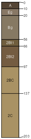
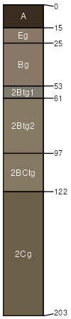
Canthook
(35%)
Loamy Upland
Aeric Albaqualfs
Somewhat poorly drained
Hydric: No
PAWS: 35 cm
flats
lake plains
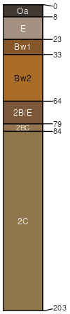
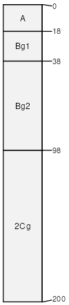
Durkeelake
(25%)
Loamy Upland
Oxyaquic Hapludalfs
Moderately well drained
Hydric: No
PAWS: 34 cm
rises
lake plains / Backslope
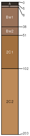
Grytal
(10%)
Sandy Upland Forest
Oxyaquic Eutrudepts
Moderately well drained
Hydric: No
PAWS: 13 cm
flats
lake plains
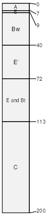
Udipsamments
(10%)
Dry Sandy Upland Forest
Somewhat excessively drained
Hydric: No
PAWS: 13 cm
hillslopes / Backslope
lake plains
Bootleg
(10%)
Depressional Wet Hardwood Forest
Typic Albaqualfs
Poorly drained
Hydric: Yes
PAWS: 30 cm
lake plains
drainageways
flats
Aquepts
(5%)
Depressional Wet Hardwood Forest
Typic Endoaquepts
Very poorly drained
Hydric: Yes
PAWS: 37 cm
depressions
lake plains
Voyageurs
(5%)
Loamy Upland
Aquic Glossudalfs
Somewhat poorly drained
Hydric: No
PAWS: 17 cm
lake plains
flats
SSA
Scale
Published
Export
mn627
1:12,000
2015
2025-09-10