Bonhigh family-Rootel-Whitesage family, complex, 2 to 15 percent slopes
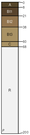
Bonhigh family
(35%)
Shallow Loamy Foothills and Basins West (SwLy)
Aridic Haplustalfs
Well drained
Hydric: No
PAWS: 11 cm
hillslopes / Backslope
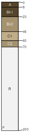
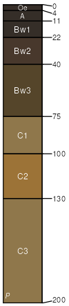
Rootel
(25%)
Shallow Loamy Foothills and Basins West (SwLy)
Aridic Calciustepts
Well drained
Hydric: No
PAWS: 8 cm
hillslopes / Backslope
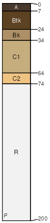
Whitesage family
(15%)
Shallow Loamy Calcareous Foothills and Basins West (SwLyCa)
Aridic Calciustepts
Well drained
Hydric: No
PAWS: 10 cm
hillslopes / Backslope
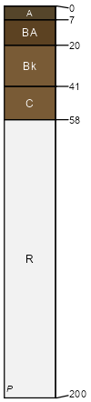
Birney family
(10%)
Shallow Loamy Foothills and Basins West (SwLy)
Aridic Haplustepts
Well drained
Hydric: No
PAWS: 5 cm
hillslopes / Backslope
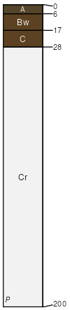
Waterhill family
(10%)
Overflow Foothills and Basins West (Ov)
Aridic Haplustolls
Well drained
Hydric: No
PAWS: 33 cm
drainageways
Craighigh taxadjunct
(5%)
Shallow Loamy Foothills and Basins West (SwLy)
Aridic Ustorthents
Well drained
Hydric: No
PAWS: 3 cm
hillslopes / Backslope
SSA
Scale
Published
Export
wy737
1:24,000
2025-09-04