Bridger-Rooset, stony-Ratiopeak, stony complex, 15 to 50 percent slopes
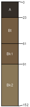
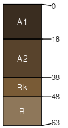
Bridger
(31%)
Upland Sagebrush Shrubland Group
Ustic Argicryolls
Well drained
Hydric: No
PAWS: 24 cm
mountain slopes
landslides
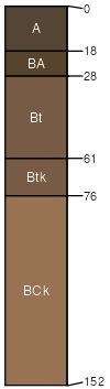
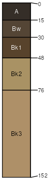
Rooset
(29%)
Upland Sagebrush Shrubland Group
Ustic Argicryolls
Well drained
Hydric: No
PAWS: 18 cm
mountain slopes
landslides
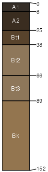
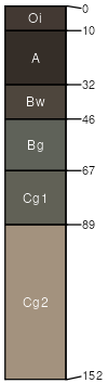
Ratiopeak
(15%)
Upland Sagebrush Shrubland Group
Ustic Argicryolls
Well drained
Hydric: No
PAWS: 17 cm
mountain slopes
landslides
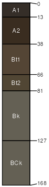
Burnette
(10%)
Upland Shrubland Group
Pachic Argicryolls
Well drained
Hydric: No
PAWS: 28 cm
mountain slopes
landslides
Cheadle
(6%)
Shallow Grassland Group
Lithic Haplocryolls
Well drained
Hydric: No
PAWS: 5 cm
ridges
Levengood
(5%)
Upland Grassland Group
Calcic Pachic Haplocryolls
Well drained
Hydric: No
PAWS: 18 cm
mountain slopes
landslides
Medicinelodge
(4%)
Subirrigated Grassland Group
Typic Cryaquolls
Poorly drained
Hydric: Yes
PAWS: 27 cm
landslides
SSA
Scale
Published
Export
mt614
1:24,000
2012
2025-08-30