Firth variant-Canburn variant complex, 0 to 3 percent slopes -- draft
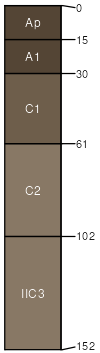
Firth
(60%)
Saline Subirrigated High Plains Southeast (SS)
Aquic Haplustolls
Somewhat poorly drained
Hydric: No
PAWS: 38 cm
flood plains / Toeslope
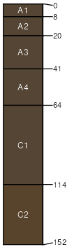
Canburn
(20%)
Wetland High Plains Southeast (WL)
Typic Endoaquolls
Very poorly drained
Hydric: Yes
PAWS: 38 cm
flood plains
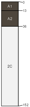
Gerrard
(10%)
Typic Endoaquolls
Poorly drained
Hydric: Yes
PAWS: NA
oxbows
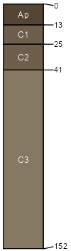
Glendive variant
(10%)
Hydric: No
PAWS: NA
SSA
Scale
Published
Export
wy630
1:24,000
2025-09-04