Blackhall-Seaverson-Rock outcrop, 5 to 40 percent slopes -- draft
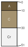
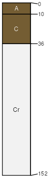
Blackhall
(40%)
Shallow Sandy High Plains Southeast (SwSy)
Ustic Torriorthents
Well drained
Hydric: No
PAWS: 2 cm
ridges / Shoulder
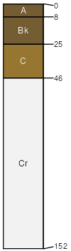
Seaverson
(30%)
Shale Green River and Great Divide Basins (Sh)
Ustic Torriorthents
Well drained
Hydric: No
PAWS: 4 cm
hills / Toeslope
ridges / Toeslope
Rock outcrop
(15%)
Hydric: No
PAWS: NA
Cragosen
(5%)
Hydric:
PAWS: NA
Carmody
(5%)
Hydric:
PAWS: NA
Blazon
(5%)
Hydric:
PAWS: NA
SSA
Scale
Published
Export
wy630
1:24,000
2025-09-04