Berwolf-Roswell association, 1 to 15 percent slopes
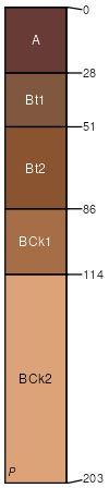
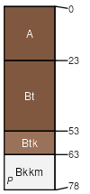
Berwolf
(60%)
Sandy Plains
Ustic Calciargids
Well drained
Hydric: No
PAWS: 23 cm
interdunes / Toeslope
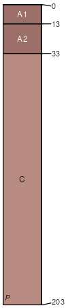
Roswell
(20%)
Sandhills
Ustic Torripsamments
Well drained
Hydric: No
PAWS: 16 cm
dunes / Summit
dunes / Shoulder
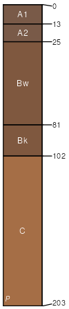
Ima
(10%)
Sandy Plains
Ustic Haplocambids
Well drained
Hydric: No
PAWS: 26 cm
interdunes / Toeslope
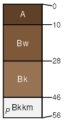
Kolar
(6%)
Shallow
Ustic Petrocalcids
Well drained
Hydric: No
PAWS: 6 cm
interdunes / Toeslope
Pojo
(4%)
Sandy Plains
Ustalfic Petrocalcids
Well drained
Hydric: No
PAWS: 7 cm
interdunes / Toeslope
SSA
Scale
Published
Export
nm041
1:24,000
2014
2025-09-09