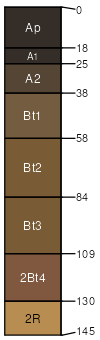
Ashdale silt loam, 5 to 10 percent slopes, eroded
Ashdale
(85%)
Shallow Upland
Mollic Hapludalfs
Well drained
Hydric: No
PAWS: 28 cm
ground moraines / Shoulder
ground moraines / Backslope
SSA
Scale
Published
Export
il201
1:12,000
1997
2025-09-01