Grosstown-Marr-Hoghole complex, 15 to 40 percent slopes
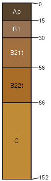
Grosstown
(31%)
Well Drained Coarse-Loamy Upland
Typic Hapludults
Well drained
Hydric: No
PAWS: 19 cm
broad interstream divides / Summit
broad interstream divides / Shoulder
broad interstream divides / Backslope
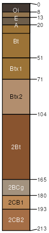
Marr
(29%)
Well Drained Fine-Loamy Upland
Typic Hapludults
Well drained
Hydric: No
PAWS: 27 cm
knolls
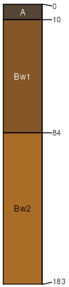
Hoghole
(15%)
Sandy, Excessively Drained Upland
Typic Udorthents
Excessively drained
Hydric: No
PAWS: 8 cm
broad interstream divides
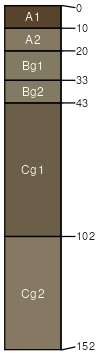
Potobac
(10%)
Wet Alluvial Floodplain
Fluvaquentic Endoaquepts
Poorly drained
Hydric: Yes
PAWS: 16 cm
flood plains
Dodon
(10%)
Moist Loamy Upland
Aquic Hapludults
Moderately well drained
Hydric: No
PAWS: 27 cm
stream terraces
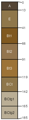
Beltsville
(5%)
Moist Loamy Upland
Typic Fragiudults
Moderately well drained
Hydric: No
PAWS: 31 cm
SSA
Scale
Published
Export
md017
1:12,000
2007
2025-09-09