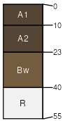
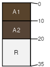
Bacbuster (35%)
Upland Sagebrush Shrubland
Typic Argiustolls
Well drained
Hydric: No
PAWS: 11 cm |
escarpments / Backslope escarpments / Footslope hills / Backslope hills / Footslope
|
|
|
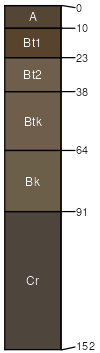
Vershal (15%)
Shallow Sagebrush Shrubland
Lithic Haplustolls
Well drained
Hydric: No
PAWS: 1 cm |
hills / Summit hills / Shoulder escarpments / Summit escarpments / Shoulder
|
|
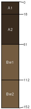
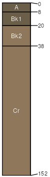
Cabba (10%)
Shallow Grassland Group
Typic Ustorthents
Well drained
Hydric: No
PAWS: 8 cm |
hills / Shoulder hills / Backslope escarpments / Shoulder escarpments / Backslope
|
|
|
|
Rock outcrop (5%)
Hydric:
PAWS: NA |

|
|