Elve-Bendoh-Mooseflat-complex, 4 to 25 percent slopes, moderately impacted
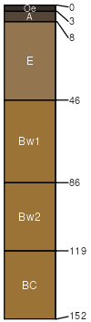
Elve
(40%)
Upland Cool Woodland Group
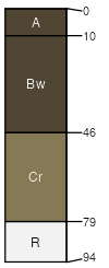
Ustic Eutrocryepts
Somewhat excessively drained
Hydric: No
PAWS: 15 cm
mountain slopes
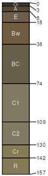
Bendoh
(25%)
Upland Cool Woodland Group
Vitrandic Eutrocryepts
Well drained
Hydric: No
PAWS: 18 cm
mountain slopes
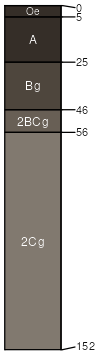
Mooseflat
(25%)
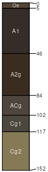
Bottomland Group
Typic Cryaquolls
Very poorly drained
Hydric: Yes
PAWS: 13 cm
drainageways
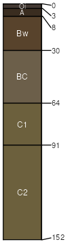
Eremis
(4%)
Vitrandic Eutrocryepts
Well drained
Hydric: No
PAWS: 18 cm
hills / Footslope
mountain slopes
Coslaw
(3%)
Vitrandic Eutrocryepts
Well drained
Hydric: No
PAWS: 4 cm
hills / Summit
mountains
Liart
(3%)
Aquandic Cryaquolls
Very poorly drained
Hydric: No
PAWS: 28 cm
mountains
flood plains
SSA
Scale
Published
Export
mt616
1:24,000
2003
2025-08-30