Agneston-Granile-Rock outcrop association, 5 to 50 percent slopes
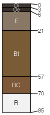
Agneston
(35%)
Coarse Upland (CU) 15-19 Foothills and Mountains East Precipitation Zone
Typic Haplocryalfs
Well drained
Hydric: No
PAWS: 8 cm
mountain slopes
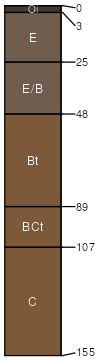
Granile
(25%)
Coarse Upland (CU) 15-19 Foothills and Mountains East Precipitation Zone
Ustic Glossocryalfs
Well drained
Hydric: No
PAWS: 10 cm
mountain slopes
Rock outcrop
(25%)
Hydric: Unranked
PAWS: NA
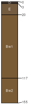
Leighcan
(6%)
Hydric: No
PAWS: NA
Tellman
(6%)
Hydric: No
PAWS: NA
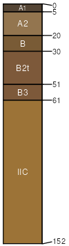
Agneston
(3%)
Hydric: No
PAWS: NA
SSA
Scale
Published
Export
wy719
1:24,000
2013
2025-09-04