More clay and less sand in the subsoil (%)
Hydric:
PAWS: NA |

|
|
Lighter colored surface layer (%)
Hydric:
PAWS: NA |
|
|
|
Till at 40 to 60 inches (%)
Hydric:
PAWS: NA |
|
|
|
Moderately well drained soils (%)
Hydric:
PAWS: NA |
|
|
|
Dark colored surface layer less than 10 inches thick (%)
Hydric:
PAWS: NA |
|
|
|
Aurand (90%)
Lake Plain Flats
Aquic Argiudolls
Somewhat poorly drained
Hydric: No
PAWS: 19 cm |
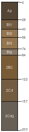
beach ridges / Footslope flats
|
|
Mermill (6%)
Hydric: Yes
PAWS: NA |
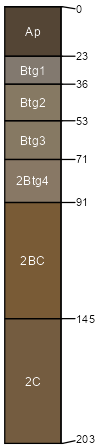
beach ridges / Footslope depressions
|
|
Alvada (3%)
Hydric: Yes
PAWS: NA |
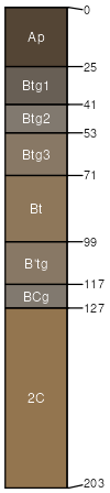
depressions beach ridges / Footslope
|
|
Rarely flooded areas adjacent to the Blanchard River and its (1%)
Hydric: No
PAWS: NA |
|
|
|