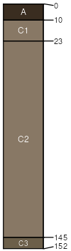
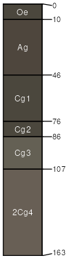
Cardwell (26%)
Subirrigated Grassland
Oxyaquic Haplustolls
Somewhat poorly drained
Hydric: No
PAWS: 14 cm |
flood-plain steps flood plains
|
|
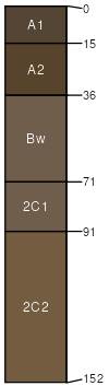
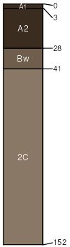
Pieriver (25%)
Subirrigated Grassland
Oxyaquic Ustifluvents
Somewhat poorly drained
Hydric: No
PAWS: 24 cm |

flood-plain steps flood plains drainageways
|
|
|
Wetsand (8%)
Bottomland
Aeric Fluvaquents
Poorly drained
Hydric: No
PAWS: 8 cm |
flood plains flood-plain steps drainageways
|
|
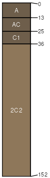
Handke (7%)
Overflow (Ov) 10-14 PZ Frigid
Oxyaquic Ustifluvents
Somewhat poorly drained
Hydric: No
PAWS: 14 cm |
flood-plain steps flood plains drainageways
|
|
Clunton (5%)
Bottomland
Fluvaquentic Endoaquolls
Very poorly drained
Hydric: Yes
PAWS: 25 cm |
|
|
|
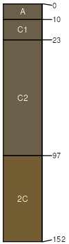
Nestley (2%)
Subirrigated Grassland
Oxyaquic Haplustolls
Somewhat poorly drained
Hydric: No
PAWS: 10 cm |
flood-plain steps flood plains drainageways
|
|