|
|
|
Rock outcrop (10%)
Hydric: Unranked
PAWS: NA |

|
|
|
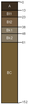
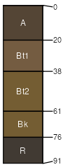
Shawmut (5%)
Upland Shrubland Group
Typic Argiustolls
Well drained
Hydric: No
PAWS: 12 cm |
hillsides escarpments alluvial fans
|
|
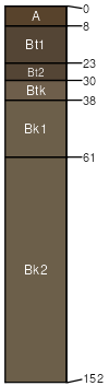
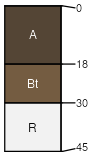
Wickes (5%)
Upland Shrubland Group
Typic Argiustolls
Well drained
Hydric: No
PAWS: 8 cm |
ridges interfluves hillsides escarpments
|
|
Rubble land (5%)
Hydric: Unranked
PAWS: NA |
|
|
|
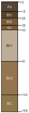
Brickner (4%)
Lithic Haplustalfs
Well drained
Hydric: No
PAWS: 3 cm |
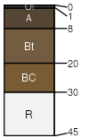
hillsides escarpments ridges
|
|
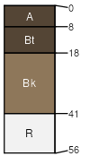
Tolbert (4%)
Shallow Shrubland Group
Lithic Argiustolls
Well drained
Hydric: No
PAWS: 3 cm |
ridges interfluves hillsides escarpments
|
|
|