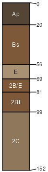
Ubly (40%)
Alfic Loamy Uplands
Alfic Haplorthods
Well drained
Hydric: No
PAWS: 36 cm |
till plains / Summit till plains / Shoulder till plains / Backslope till plains / Footslope till plains / Toeslope
|
|
Moquah (30%)
Floodplains
Typic Udifluvents
Moderately well drained
Hydric: No
PAWS: 31 cm |
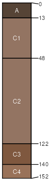
flood plains / Summit flood plains / Shoulder flood plains / Backslope flood plains / Footslope flood plains / Toeslope
|
|
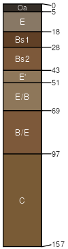
Arnheim (20%)
Floodplains
Typic Fluvaquents
Poorly drained
Hydric: Yes
PAWS: 38 cm |
|
|
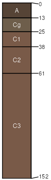
Loggerhead (5%)
Alfic Loamy Uplands
Alfic Oxyaquic Haplorthods
Moderately well drained
Hydric: No
PAWS: 32 cm |

till plains / Summit till plains / Shoulder till plains / Backslope till plains / Footslope till plains / Toeslope
|
|
Annalake (3%)
Alfic Loamy Uplands
Alfic Oxyaquic Haplorthods
Moderately well drained
Hydric: No
PAWS: 31 cm |

|
|
Robago (2%)
Moist Lowlands
Argic Endoaquods
Somewhat poorly drained
Hydric: No
PAWS: 26 cm |
|
|