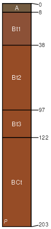
Cecil sandy clay loam, 6 to 10 percent slopes, moderately eroded
Cecil
(91%)
Acidic upland forest, moist
Typic Kanhapludults
Well drained
Hydric: No
PAWS: 30 cm
interfluves / Shoulder
interfluves / Backslope
SSA
Scale
Published
Export
ga215
1:16,000
1980
2025-08-29