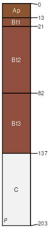
Cecil sandy loam, 6 to 10 percent slopes, moderately eroded
Cecil
(88%)
Acidic upland forest, moist
Typic Kanhapludults
Well drained
Hydric: No
PAWS: 32 cm
interfluves / Backslope
interfluves / Shoulder
interfluves / Summit
SSA
Scale
Published
Export
ga147
1:20,000
1961
2025-09-02